Peak 545
Posted by Derek on May 10, 2022
Height: 1788 feet / 545 meters
GPS recorded height: 1785 feet / 544 meters
Lat/Lon: N45.64952 W79.01674
Date Summited: May 8, 2022
Peak 556
Posted by Derek on May 10, 2022
Height: 1824 feet / 556 meters
GPS recorded height: 1821 feet / 555 meters
Lat/Lon: N45.78757 W79.11161
Date Summited: May 8, 2022
La Cloche Silhouette Trail
Posted by Derek on Nov 26, 2021
Dates Hiked: August 5, 2021 – August 10, 2021
Overview:
The La Cloche Silhouette Trail is a rugged 80 km backpacking trail located in Killarney Provincial Park. This challenging yet rewarding trail passes over white quartzite rock ridges, through valley bottoms and alongside picturesque crystal clear lakes. The trail is named for Group of Seven painter Franklin Carmichael’s painting “La Cloche Silhouette”. The campsites along the trail must be specifically booked in advance through Ontario Parks.
Mount Ararat
Posted by Derek on Oct 22, 2021
Height: 1247 feet / 380 meters
GPS recorded height: 1276 feet / 389 meters
Lat/Lon: N46.12202 W81.79488
Date Summited: August 14, 2021
Ishpatina Ridge (North Peak) – Overland
Posted by Derek on Sep 23, 2019

View to North Ishpatina summit
Height: 2234 feet / 681 meters
Lat/Lon: N47.333 W80.7336
Clean Prominence: 604 feet / 184 meters
Line Parent: Ishpatina Ridge (Tower Summit)
Key Col: N47 19.742 W80 44.593 (1640 ft / 500 m)
GPS recorded height: 2247 feet / 685 m
Date Summited: August 9th, 2019
Overview:
The Ishpatina Ridge traverses several rounded humps and under the Ontario 2100 Footer criteria, 3 of these qualify as being distinct 2100+ foot peaks. The familiar Fire Tower summit of the Ishpatina Ridge is the highest point in Ontario and a popular destination. It is reachable via a trail from Scarecrow Lake. The North Peak as seen from the Fire Tower summit appears to be just as high, but according to Ontario’s Ministry of Natural Resources Ontario Base Maps (OBM) series, it is 43 feet lower. There is no trail to the North Peak of the Ishpatina Ridge and the route from Ishpatina – Tower Peak is hindered by the steep cliffs surrounding the peak.
White Mountain / Lanark County High Point
Posted by Derek on Mar 27, 2018
aka. Lanark County High Point
Height: 1266 feet / 386 meters
GPS recorded height: 1270 feet / 387 meters
Lat/Lon: N45.1810083 W76.6381359
Date Summited: July 4, 2017
Parch Creek Peak East
Posted by Derek on Sep 12, 2017
Parch Creek Peak East as seen from a clearing on route
Height: 2123 feet / 647 meters
Lat/Lon: N47.6288 W84.3851
Clean Prominence: 548 feet / 167 meters
Line Parent: Blackspruce Lake Peak
Key Col: N47 37.329 W84 18.058 (1585 ft / 483 m)
GPS recorded height: 2153 feet / 656 meters
Date Summited: September 2nd, 2017
Overview:
Parch Creek East Peak is a remote peak in the Algoma Wilderness, located 24 km north-northeast of the Agawa Canyon and 10 km southeast of Millwood, a stop along the Algoma Central Railway. Parch Creek, the closest significant body of water from which the mountain is named, winds it’s way west into the Agawa River at the Algoma Central Railway.
Ghost Range Peak
Posted by Derek on Aug 10, 2017
Height: 1601 feet / 488 meters
GPS recorded height: 1607 feet / 490 meters
Lat/Lon: N48 32.326 W79 50.106
Date Summited: July 31, 2017
Overview:
Ghost Range Peak is a 2.7 billion year old layered intrusion / sill located south of Lake Abitibi. It is the highest point in Ontario’s Cochrane District. It’s a short hike to the summit along trails that depart from a sand quarry located near the corner of Hwy 101 and Hwy 672. The fire tower that once stood at the summit was recently removed by Ontario’s Ministry of Natural Resources.
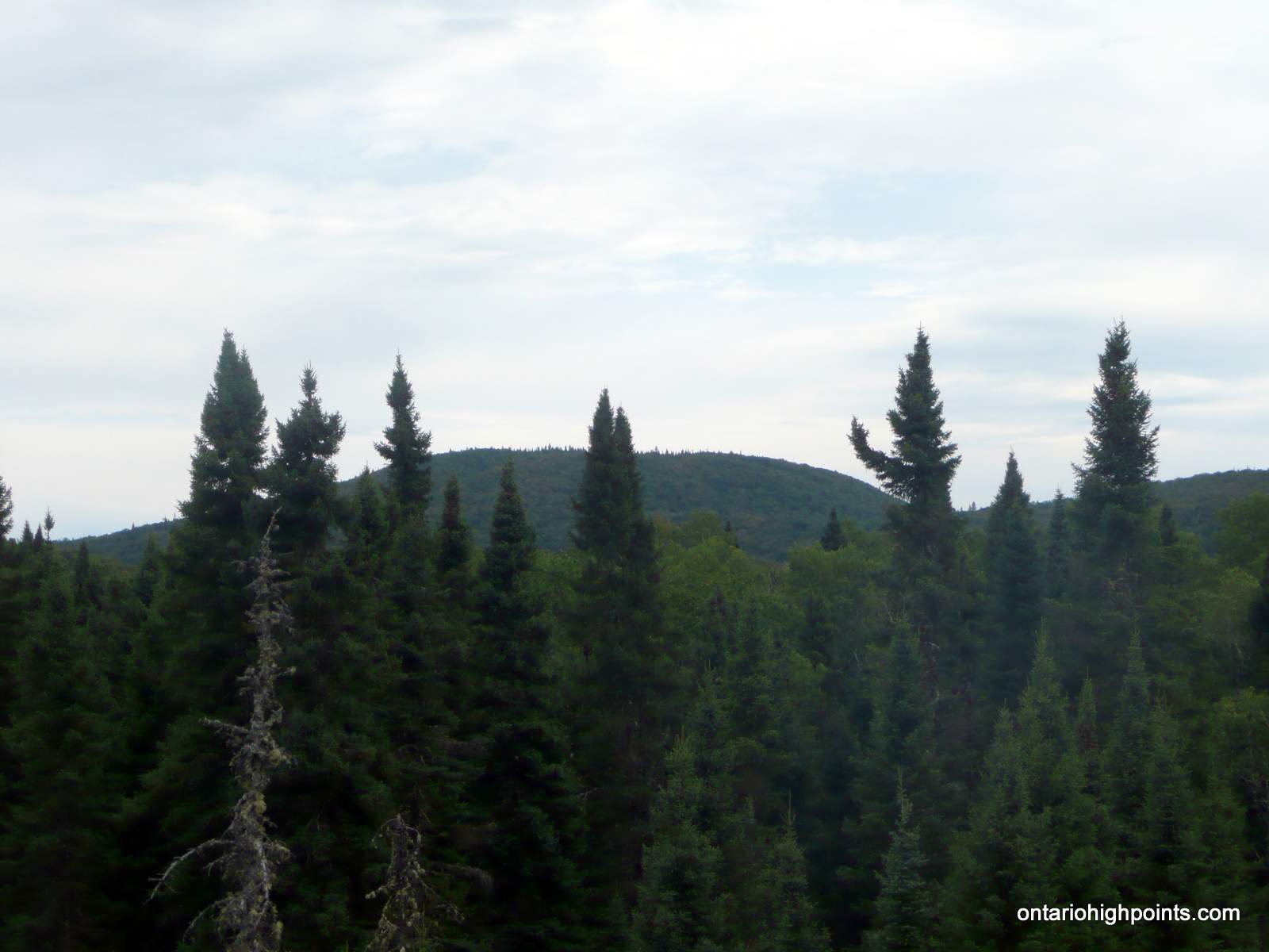
Rainy River District High Point
Posted by Derek on May 1, 2017
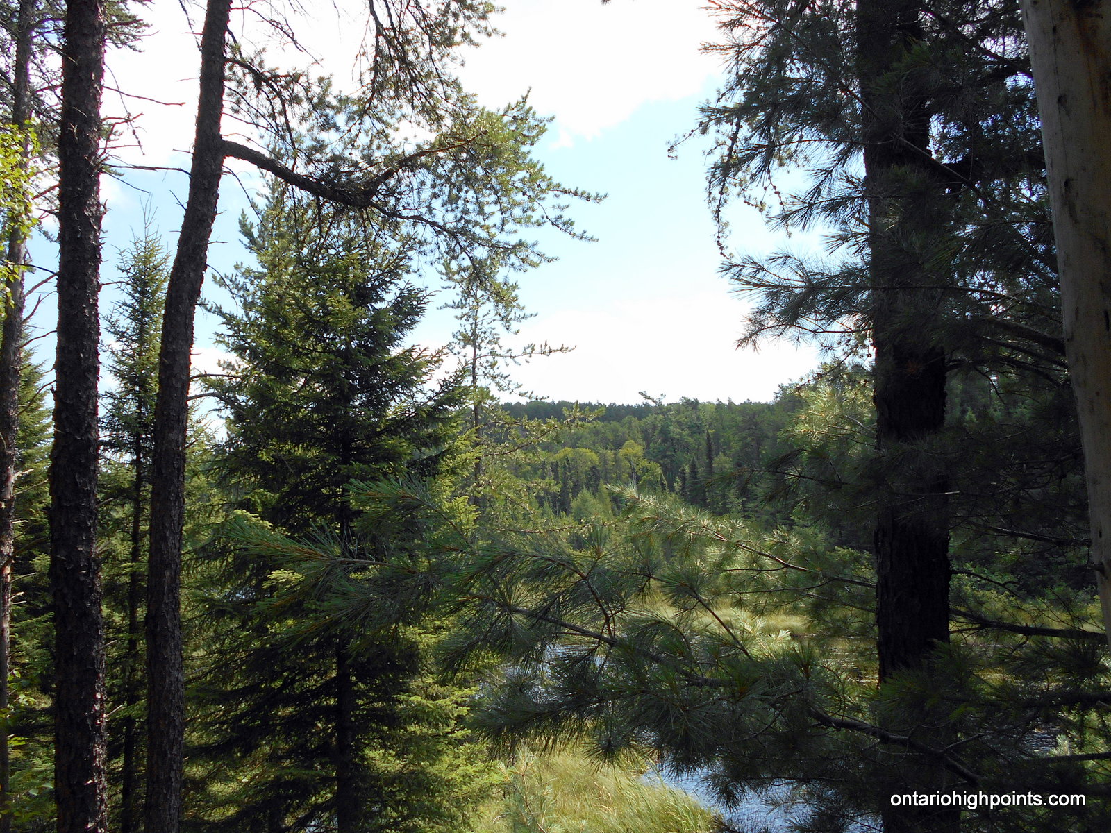
Rainy River District High Point visible between the trees
Height: 1785 feet / 544 meters
This is the elevation at the spot height. The elevation at the highest point was found to be significantly higher
GPS recorded height: 1857 feet / 566 meters
Lat/Lon: N48 09.967 W91 15.364
Date Summited: August 4, 2016
Overview:
The Rainy River District High Point is located 7 km north of the Minnesota-Ontario border in Quetico Provincial Park. Only accessible by canoe, the shortest route to the peak is from Minnesota’s Boundary Waters Canoe Area via the backcountry border crossing/ranger station at Prairie Portage. Permits are both required for the remote border crossing and to enter Quetico Provincial Park.
Little North Lake Peak
Posted by Derek on Feb 24, 2017
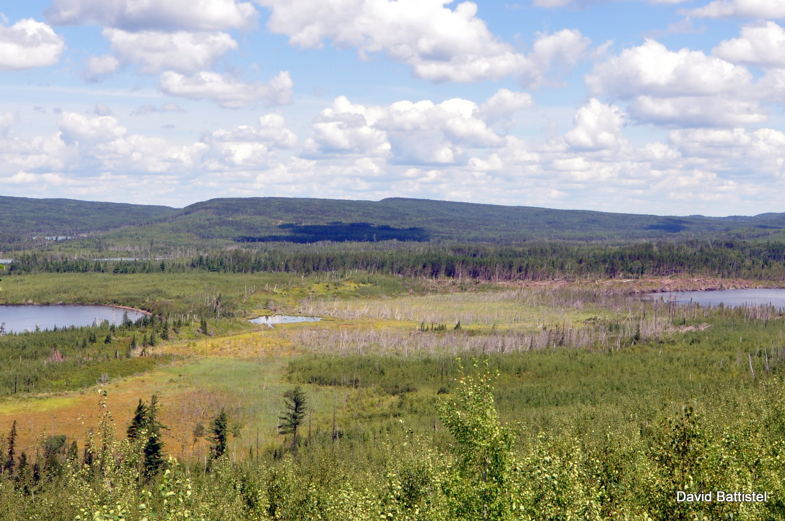
Little North Lake Peak as seen from the Border Route Trail, MN
Height: 2100 feet / 640 meters
Lat/Lon: N48.1396 W90.5864
Clean Prominence: 436 feet / 133 meters
Line Parent: Prelate Lake Peak
Key Col: N48 11.169 W90 22.162 (1706ft / 520m)
GPS recorded height: 2119 feet / 646 meters
Date Summited: July 31, 2016
Overview:
Rising 500 feet above the Gunflint-North Lake chain, Little North Lake Peak lies at the southwestern edge of a range of hills west of Thunder Bay. Situated just 2 km north of the (Minnesota-Ontario) border, the peak can be accessed via a rough trail which traces the route of the defunct Port Arthur, Duluth & Western Railway.