Ogidaki Mountain
Posted by Derek on Jan 21, 2009
Height: 2182 feet / 665 m
GPS recorded height: 2200 feet / 671 m
Lat/Lon: N46 59.533, W83 59.015
Line Parent: Ishpatina Ridge (Tower Summit)
Key Col: N47 27.157 W81 01.900 (1250ft / 381m)
Clean Prominence: 932ft / 284m
Date Summited: July 22, 2008
Overview:
Ogidaki Mountain, a high hill in the Algoma Highlands north of Sault Ste. Marie, was once thought to be the highest point in Ontario. With the release of the 1:50,000 series topographical maps in 1970, the Ishpatina Ridge took top honour as the highest peak. Ogidaki now sits at #7, and depending on who you ask is 2182 feet high. Today, although a series of active and overgrown logging roads lead to the summit, it is seldom visited. A fire tower once stood at the summit.
Edit: Ontario’s Ministry of Natural Resources removed the fire tower in May of 2016.
Directions:
From Sault Ste. Marie, take Highway 17 North and at the junction with 556, turn East. Stay on 556 for 25.5 km and then turn left on 532 North to Searchmont (ski area). Stay on 532 for 4 km, cross the Goulais River in Searchmont, and turn East on Whitman Dam Road. This road starts off paved for the first 5 km, after which it turns into a dusty gravel road. Stay on the main road which will meander in a northerly direction for 32 km. Beware of the logging trucks, as this area is actively logged. At (N46 59.059 W83 56.220), there is a left fork to a less traveled, but recently cleared and bulldozed dirt road. City cars should be parked on the road shoulder here. 4×4’s can be taken further as long as there is no logging activity present (At the time of the hike: July 22, 2008, this road was actively being logged, preventing any pedestrian motorized travel.) Keep to this main dirt logging road and avoid the less traveled side trails. The dirt road passes forks at the 1 km and 5 km marks: stay on the main dirt road, taking the left fork in both instances. At 5.9 km (N47 00.373 W83 59.476) the main dirt road opens into a larger cleared area. Turn left and take the overgrown road heading south into the woods. 0.8 km from this junction (6.7 km from Whitman Dam Road), another overgrown road forks left. (Unconfirmed: but based on the Atlas of Canada Toporama site, the left fork appears to head back and intersect with Whitman Dam Road 2.4 km south of the main parking area.) Take the right fork proceeding south-west. During rainy periods, the trail may be flooded and these areas will need to be skirted. 750 m from the right fork, there is the old Ogidaki fire towerman shack on the left side of the trail. 1.1 km beyond this an MNR fire tower marks the summit of Ogidaki mountain. The summit is cleared, however tall trees at the edges of the clearing obscure views.
View a larger version of the map
Hiking Log:
Having successfully climbed Griffin Lake Peak the previous day, Val and I set our sights on Ogidaki Mountain. Ogidaki was even more remote and I had little information about the route to go on. We left Pancake Bay Provincial Park, where we were camping, bright and early, since just getting to the trailhead would take some time.
It took us well over an hour to go south on Highway 17, across to 556 (via 552 through Kirby’s Corner) and finally North on 532 to Searchmont. Road construction had slowed us up, but we finally arrived in Searchmont at 9:00 AM We crossed the bridge over the Goulais River and found the turn off to Whitman Dam Road. From Searchmont, the 32 km drive over narrow single lane bridges, across rough gravel terrain, evading oncoming logging trucks to the side road turn off took us 50 minutes.
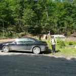
We thought we were in some pretty remote country, when we noticed 2 old ladies drive past us in a Corolla. Further back I had seen signs (for snowmobilers presumably, as this road is used as a snowmobile trail in the winter), that indicated the road went all the way to Wawa. I couldn’t be sure if they were coming from Wawa, but I’m certain this road would not by my preferred route. I also noticed that the sideroad we were to travel up was not only unsuitable for a city car, but it was currently undergoing active logging operations. This meant that we would be parking the car here and beginning the hike on foot.
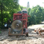
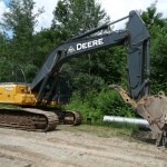
The side road was well cleared and had recently been bulldozed. There would be no way we’d get lost on this road. We passed loggers, their trucks, their machinery, and the fruits of their labour: large piles of timber. And although the cleared roads weren’t pretty, they made quick travel. Compared to the day before, there were very few bugs, perhaps in part due to the scope and extent of the road work.
We hiked up the main bulldozed road for 6 km, avoiding the smaller side trails at the 1 and 5 km marks and came into a larger cleared area. Although it looked like the logging road narrowed and continued to the northwest, this seemed to be the terminus of the main road we came in on. This was also the spot where my maps indicated a road to the south would take us to Ogidaki Mt. We found the trailhead to an narrow overgrown track on our left, and after a brief break, we were on our way.
This trail, similar to the overgrown trail we encountered on our way to Griffin Lake was a jumble of flooded areas, fallen trees and uncleared bush, but nevertheless easy enough to follow. After 0.8 km we came to a fork. Based on my maps I figured the left fork heading southeast was an alternate route I had originally looked to take. Possibly a little shorter, but as I had encountered the day before, maps can be wrong, and bush trails can be overgrown and disappear; besides the route we had traveled had been well established and made for an easy hike so far.
1 km beyond the fork, we came upon the Ogidaki fire towerman shack, very much in a state of disrepair. The windows had been smashed and walls and flooring had seen some trauma, but it appeared to have be recently used as I noticed a bottle of Sunlight detergent beside the kitchen sink. Beyond the shack the trail climbed moderately and we found ATV tracks as well as some spent shotgun shells. Finally 1.1 km past the shack, the trail ended at the cleared summit of Ogidaki mountain. A well preserved fire tower and a Ministry of Natural Resources shack stood at the edge of the clearing; it’s bottom ladder missing, as to prevent people from climbing to the lookout. Val and I spent some time resting in the sun and unlike our previous day’s outing to Griffin Lake Peak, without large amounts of mosquitoes and blackflies. Despite the clearing at the summit, tall trees obscured any possible view.
I took a GPS elevation reading at the summit and curiously got numbers higher than what some sources report for Ogidaki. Averaging my readings together I got 2200 feet +/- 18 feet as the height of Ogidaki.
The total distance from the parking area on Whitman Dam Road to the summit of Ogidaki Mountain is 8.5 km (17 km with return). Our total hiking time from the car to summit with return was 4 hours 45 minutes.
Ogidaki Mountain GPS Track (.gpx format)
Related Links:
Ogidaki Mountain on Summitpost
confluence.org: 47°N 84°W
Dan Kachur’s Web Portal
Atlas of Canada Toporama
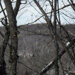

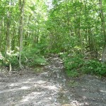
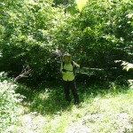
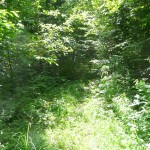
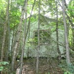
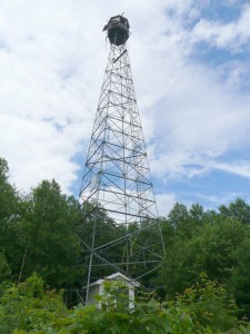
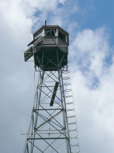


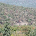
Active logging and many…and I mean many skidder trails have abolished most of the area just ENE of Ogidaki. The logging road is still intact, but now meanders a good extra 20 km. If you look on atlas of canada topo maps, there’s a trail just at around 38km, we took that route first. Once you hit the base of the mountain, there’s a swamp/bog, and then flags mark the way through some bushwacking. It’s a nice ascent this way, but a good two hour hike. 🙂
Matti, thanks for the trail update and the photos from the fire tower. I’ll post them here for others to enjoy.
This past Spring (2010) Meakin Forest Logging moved in and has improved and widened the roads. You can now drive a car right to the base of the mountain (stops at the Old Forest Ranger Camp) and catch the original trail to hike up the mountain. It takes about 20 minutes to get to the top. Dan (Sault Ste. Marie)
We just hiked up Ogidaki on Thursday 2012-05-26. The lumber roads have been purposefully ditched in several locations on various approaches, so it is not possible to drive right to the old Ranger Camp any longer. We still got within two klicks of the summit, but unless you are willing to risk one ditch crossing that was not too bad, then 2.6 kilometres is as near as you can get. Our averaged elevation for the summit was 666 metres.