Peak 551
Posted by Derek on Oct 19, 2024
Height: 1808 feet / 551 meters
GPS recorded height: 1831 feet / 558 meters
Lat/Lon: N45.62246 W78.42301
Date Summited: April 26, 2024
Overview:
Peak 551 is situated along the Hwy 60 corridor at the eastern edge of Algonquin Park. This forested summit is accessible via Sunday Lake Road, but it requires a final short and steep bushwhack to reach the top.
MacDougall & Centennial Ridge Mountain
Posted by Derek on Oct 18, 2024
MacDougall Mountain
Height: 1837 feet / 560 meters
Lat/Lon: N45.56789 W78.40721
Date Summited: April 26, 2024
Centennial Ridge Mountain
Height: 1608 feet / 490 meters
Lat/Lon: N45.56236 W78.41668
Date Summited: April 26, 2024
Overview:
MacDougall Mountain is the highest point on the Centennial Ridges in Algonquin Provincial Park, Ontario. It is accessible via the Centennial Ridges Trail, which also features Centennial Ridge Mountain along its route. A short bushwhack is needed to reach MacDougall’s summit, where the views are limited.
White Mountain / Heaven’s Gate Trail
Posted by Derek on Sep 25, 2024
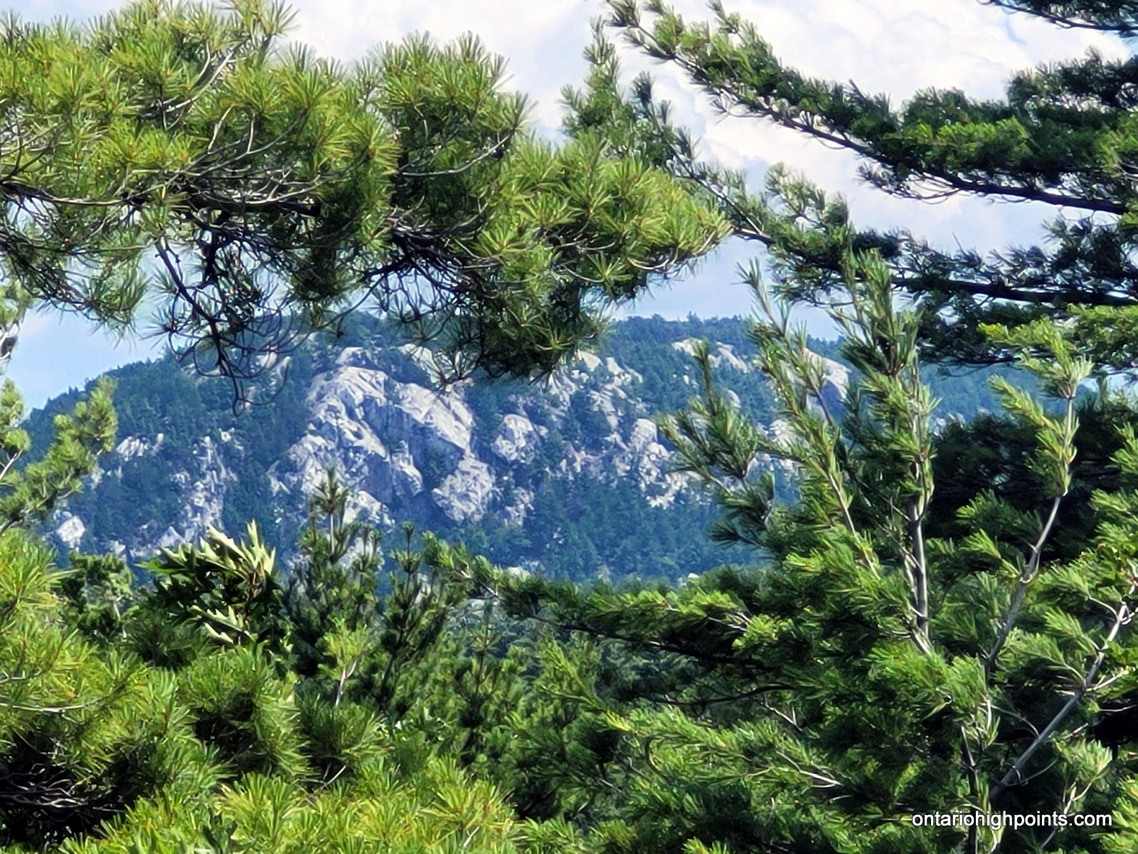
View of White Mountain
Height: 1362 feet / 415 meters
GPS recorded height: 1371 feet / 418 meters
Lat/Lon: N46.10145 W81.96931
Date Summited: July 18, 2024
White Mountain – West Peak
Height: 1362 feet / 415 meters
GPS recorded height: 1362 feet / 415 meters
Lat/Lon: N46.10359 W81.97624
Date Summited: July 18, 2024
Overview:
White Mountain is situated within La Cloche Provincial Park and ranks as one of the highest peaks in the western La Cloche Mountain Range. Although there are no established trails leading to the summit, the Heaven’s Gate (Kitchitwaa Shkwaandem) Trail comes within 1.5 km (northwest) of the peak. Adventurers can take a side trip to bushwhack their way to the mountain during a multiday backpacking trek along this trail. The mountain features two potential high points: an east peak and a west peak. Unofficial GPS measurements indicate that the east peak is slightly higher. From the summit, hikers can enjoy stunning views of Lake Huron’s North Channel.
Tip Top Mountain
Posted by Derek on Jul 28, 2023
Ontario 2100 Footer Rank: 20
Height: 2103 feet / 641 meters
Lat/Lon: N48.2734 W86.0037
Clean Prominence: 988 feet / 301 meters
Line Parent: Blackspruce Lake Peak
Key Col: N48 17.390 W83 57.048 (1115ft / 340m)
GPS recorded height: 2113 feet / 644 m
Date Summited: July 23, 2023
Description:
Tip Top Mountain is located in Pukaskwa National Park which is on the northeast shore of Lake Superior between Wawa and Marathon Ontario. Its summit is 641 m (2,103 ft) above sea level and 457 m (1,500 ft) above Lake Superior. It lies north of the Swallow River, about 10 km inland from Pukaskwa’s Coastal Trail and Lake Superior. Before 1966, Tip Top Mountain was considered the highest point in Ontario. Read the rest of this entry »
Parkin Fire Tower
Posted by Derek on Jun 12, 2023
Height: 1608 feet / 490 meters
GPS recorded height: 1608 feet / 490 meters
Lat/Lon: N46.86917° W80.83735°
Date Summited: May 23, 2023
Dividing Lake Provincial Park High Point
Posted by Derek on May 13, 2023
Height: 1772 feet / 540 meters
GPS recorded height: 1772 feet / 540 meters
Lat/Lon: N45.39214° W78.59730°
Date Summited: May 6, 2023
Overview:
Dividing Lake Provincial Park High Point is a non-operating/nature reserve class park and was established to protect spectacular old growth pine and hardwood forests. This remote park is situated between the southwestern border of Algonquin Park / Dividing Lake and Rockaway/Dagger Lakes to the west. This area can be accessed via the Dagger Lake Access Road (which can be accessed from Livingstone Lake Road) or via the Wildcat Canoe Route, which links this Nature Reserve to Algonquin Park. The park’s high point is at its southeast side, 500 meters west of the Algonquin boundary line.
Thunder Mountain
Posted by Derek on Oct 26, 2022
Height: 1788 feet / 545 meters
Lat/Lon: N46.64809 W82.64413
Date Summited: October 9, 2022
Old Baldy & Wilkie Lake Peak / Fire Tower
Posted by Derek on Oct 20, 2022
Old Baldy
Height: 1827 feet / 557 meters
Lat/Lon: N46.57680 W82.82519
Date Summited: October 9, 2022
Wilkie Lake Peak / Fire Tower
Height: 1834 feet / 559 meters
Lat/Lon: N46.58915 W82.84388
Date Summited: October 9, 2022
Fraleck Ridge
Posted by Derek on Oct 19, 2022
Height: 1608 feet / 490 meters
GPS recorded height: 1640 feet / 500 meters
Lat/Lon: N46.91859 W80.86182
Date Summited: October 8, 2022
Peak 486
Posted by Derek on Sep 12, 2022
Height: 1594 feet / 486 meters
GPS recorded height: 1594 feet / 486 meters
Lat/Lon: N46.69648 W81.17519
Date Summited: July 26, 2022