Ishpatina Ridge (Tower Summit)
Posted by Derek on Jan 25, 2009
Height: 2275 feet / 693 m
GPS recorded height: 2292 feet / 699 m
Lat/Lon: N47 19.013, W80 44.964
Key Col: N49 32.433 W85 35.183 (981ft / 299m)
Clean Prominence: 1293ft / 394m
Date Summited: September 2, 2007
Overview:
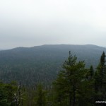
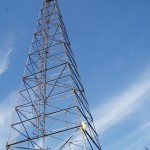
The Ishpatina Ridge, set in a remote corner of the Lady Evelyn-Smoothwater wilderness park, is a series of worn and rounded bumps spanning approximately 13 km. The Ellis Fire Tower, a lonely sentry and reminder of days of old, sits on the tallest of the bumps and looks out across the vast expanse of Canadian Shield wilderness. At a height of 2275 feet / 693 m, the Ishpatina Ridge is the highest point in Ontario.
Directions:
There are 2 routes to the Ishpatina Ridge:
- The traditional and most common route begins as a multi-day canoe trip up the Montreal River, over a series of lakes and portages between Smoothwater Lake and Scarecrow Lake and ends with a hike up to the summit via an old fire tower watchman’s trail.
- More recently, many hikers have begun to use an overland route accessed via a series of logging roads which are accessed north of Capreol (near Sudbury). Most hikers begin on foot or by bike at a rugged road crossing of the Sturgeon River and follow the road north to a series of overgrown bush trails. Combined with a bushwhack along the west shore of Scarecrow Lake and the usual fire tower trail hike from the trailhead on Scarecrow Lake, many hikers are able to complete the trip from car to car in a long day hike.
Click here for my trip report to Ishpatina Ridge – Overland Route.
Directions via the traditional canoe route is as follows:
From New Liskeard, proceed on 65 west to Elk Lake and upon arrival, continue on to 560 west for 23 km to the intersection with Beauty Lake road. Make a left on this rough gravel road and follow for 12.5 km until a fork. Keep right and continue on for another 11 km until reaching the Montreal River. The parking area and boat launch is on east side of the river, just before the bridge crossing.
Canoe south on the Montreal River through Lady Dufferin Lake, to Smoothwater lake, which despite it’s namesake, can often be rough. 15 km from the road, at the midpoint of the eastern shoreline, is an excellent campsite, often referred to as the Kirsch memorial campsite. It is a fairly easy paddle to this spot and depending on the conditions of Smoothwater would take most parties 3 hours to reach.
From the Kirsch campsite, proceed to the south tip of Smoothwater, where there will be a portage and a nearby creek. The portage to Apex Lake is 800 m. On Apex Lake, avoid the portage on the southeastern shore which goes to Whitemud Lake, and find the portage on the southernmost point of the lake. This portage heads south for 1.1 km to a series of 3 small unnamed lakes and over 3 short portages (the longest being 130 m) until reaching McCulloch Lake.
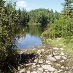
Head south, crossing the 1.7 km length of McCulloch Lake, to another short 100 m portage to Scarecrow Creek which drains into Mihell Lake. (Watch out for leeches!) The northern end of Mihell Lake is very shallow, but deepens at the southern end. Looking up and to the west, the fire tower on the Ishpatina Ridge can be seen from here. At the southwestern end of the lake, a short portage leads to another small lake. It is a short canoe paddle along the western side of this lake to the final (8th), but longest (1.3 km) portage of the trip, to Scarecrow lake.
On Scarecrow Lake, there are 2 camping options. There is a small island about 1.5 km south-southwest of the portage, near the western shore which might be a good option for a small group. A larger campsite exists on the northwestern shore of the lake, and a nearby burnt out area marks the start of the trail to the Ishpatina Ridge. There is also a cabin on the northern shore of the lake.
From Scarecrow Lake it is a 4.0 km trek to the summit. The trail is fairly easy to follow, despite the fact that it is not maintained. It stays fairly level for the first half and passes by 2 small lakes and some swampy areas. After the 2nd lake, the trail begins to climb moderately and then crosses a beaver dam at Dick Lake. From here, it is a short distance to the fire tower and 360 degree views on the summit. A possible, but unconfirmed higher point of land may exist 250 m to the northwest of the summit, but GPS measurements have all been inconclusive.
View a larger version of the map
Hiking Log:
My obsession to climb the Ishpatina Ridge, began as an innocent internet search. I had stumbled across Ken Takabe’s trip report to Ishpatina which drove me to attempt a solo trip to the ridge on July 22, 2006. I was planning to get to the ridge in a day via Ken’s route, but predictably ran out of time and had to turn back. I began the trip from Sudbury, left the city at the crack of dawn, and made my way north to 72 km of winding logging roads. When the roads became too tough for my car, I switched to mountain bike and finished up the last 27 km of rough road. I had just begun the bushwhack at Woods lake when I decided that I would not make it out before sunset, a foreboding prospect since I was alone, deep in the wilderness. Turning back, I vowed to return to climb the Ishpatina Ridge.
So I began to plan for a more realistic multi-day canoe trip to the Ridge, starting from the Montreal River access point on Beauty Lake. Over the September Labour Day long weekend of 2007, this trip became a reality; I was joined by Rochelle, Darcy, Val and Matt. This was to be a 5-day canoe trip: 2 days for the canoe in, 1 day for the hike and 2 days for the canoe out.
Our 5 person team assembled at the Wilderness Dreams outfitter in New Liskeard, as Val, Matt and I had to rent a 3 person canoe for the trip. Once the canoe was safely fastened on the car, we started out towards Elk Lake and beyond via 56 with Darcy and Rochelle in tow. 23 km past Elk Lake, we found the turn off onto the more arduous Beauty Lake road.
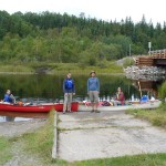
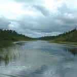
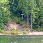
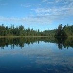
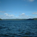
For a supposedly remote area, there were a surprising amount of cars parked at the boat launch. We arrived just in time to see a couple of men set off on a fishing trip to Lady Dufferin Lake. After having a quick lunch and preparing our gear, we set off on our trip. The Montreal River was gentle and fairly wide; we made better time than I was expecting, considering that most of us were novice canoeists. We paddled past the cottage and memorial cross on Lady Dufferin and then onto a calm Smoothwater Lake. It was just before 4, exactly 3 hours since departing the boat launch, when we stormed ashore to the campsite beside the Marina Lake portage.
At Apex, we opted to pass up the side trip to Whitemud lake, and headed south over another lengthy portage to a string of 3 smaller lakes connected by short portages. At McCulloch Lake, we finally enjoyed a longer trip over the water and headed towards the portage to Mihell Lake. It was during this haul, that I enjoyed a close encounter with a leech. I really hate leeches and here was one latched to my ankle. Unable to stay calm, I screamed and yelled for someone to get a lighter; I’m sure my antics were highly amusing for my companions. Eventually they took pity on me and got it off.
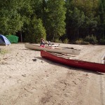
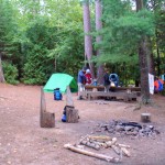
After the drama at the Mihell (or as I was now calling it: My Hell) portage, we got our first glimpse of the fire tower and the highest point of the Ishpatina Ridge. We had 2 portages to go: a short one from Mihell to a small unnamed lake, and then our 8th and longest portage to Scarecrow lake.We finally arrived on Scarecrow Lake as dusk was approaching. We had yet to find a campsite, but after examining and declining to camp on the island, we pulled our canoes ashore at the trailhead and setup at the nearby campsite. It had been a long day, and we made good use of the remaining daylight. As the night approached, we were invaded by a small army of mice. We scrambled to react; closing up our bags and tents, and putting our foodstuffs away. Matt would later discover that the mice had an appetite for his toilet paper.
The following day, we were overjoyed at not having to break camp. We could have a leisurely hike to the top of the ridge and spend quality time relaxing by the water. I had no such plans. My goal was to not only climb the main tower summit, but to traverse across the ridge to the northern summit (#3) and the smaller southern knob (#5). As the wind picked up, we were thankful to not be on the water, and headed up the trail. There were a few marshy areas on route, which required hopping from log to log, but we finally got to the beaver dam at Dick Lake.
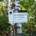
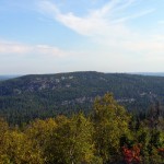
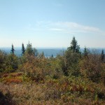
Shortly past Dick Lake, we came to the Ministry sign, informing us to stay off the fire tower which we could just begin to make out through the trees. As we exited from the trees into a clearing we were greeted by the fire tower and 360 degree views. We had reached the summit of Ishpatina: the highest point of Ontario! As we soaked in the scenery, the feeling of remoteness began to set in.
Exploring the area, we discovered the smashed remains of a Nalgene bottle. It had been used as a kind of log book repository and there were bits of paper with people’s names all over. We did our best to gather it all up and reinforce the container, however damaged it was. After that, I managed to convince everyone that according to internet rumors the height of land was actually 250 m to the northwest and we had to check it out. So after what seemed an eternity of bushwhacking for a whole 250 m of gain, we decided that we had found the other height of land. GPS measurements did not confirm that this point was any higher than at the tower and we headed back.
It was starting to get hot and I was getting anxious to set off to the northern peak. Matt said he would join me, so we bid farewell to Rochelle, Darcy and Val and headed off through the bush. Compared to our bushwhack back on the summit, the forest here was sparser and it made for easy passage. I had my GPS in hand and followed a bearing northeast, straight towards the north peak. However, at a mere 500 m from the summit, we hit a brick wall. A steep wall of cliffs dropped away below us. There was no way that we were prepared to descend these and it didn’t look we’d be able to go around them.
The day was growing hotter and with sweat was pouring down my face, I asked Matt if he wanted to continue. We decided together that there was no way we’d be able to descend the cliffs safely and we’d have to find another approach. I think at this point I also gave up descending to lower southern peak. In my mind, the southern summit would be a difficult bushwhack with no views, and coupled with the heat of the day and the previous days excursion, the prospect was becoming less and less attractive. We began the journey back and enjoyed the remainder of the day in the relative comfort of camp.
Over the next 2 days, we made our way back to our cars on Beauty Lake road. Unlike our trip down from Smoothwater Lake, we left early enough to arrive at the Kirsch Campsite at a decent time, despite the rough waters awaiting our return to Smoothwater. The rest of the trip back went smoothly and we got back to our cars early enough that we could make the 8 hour drive home.
Succeeding in my quest to submit Ontario’s highest peak, but failing on my other objectives was bittersweet. Many would ask why undertake such an endeavor at all and I can’t help but give the standard peakbagger reply: because it’s there. It is for this reason that I decided to create a website to share my thoughts and experiences; an attempt to reach out to a community of Ontario peakbaggers and bring awareness to my home province’s hiking potential.
Ishpatina Ridge GPS Track (.gpx format)
Related Links:
Ishpatina Ridge on Summitpost
Ottertooth: In-depth: Ishpatina
Chris Lawson and Marcus Wandel’s canoe trip to Ishpatina
Deseronto’s Ishpatina trip report (canoe route)
Ken Takabe’s: pioneer of the overland route to Ishpatina
Andrew Lavigne’s detailed day trip to Ishpatina via the overland route
Firla and Matt’s adventures on the overland route to Ishpatina
Cachemania: geocache event on Ishpatina


My friend and I just used your route to get to Ishpatina. It was our first canoe trip and it went really well! Smoothwater was rough for us as well, especially southbound. Just some other update info: We did the whole thing in two days, leaving the launch at dawn Saturday and getting back at 6pm Sunday. Beauty lake road is pretty well marked, with km markers and a sign at the major fork. The walk up to the ridge had just undergone some maintenance by the warden and jr. rangers, so it was pretty clear and was well marked with ribbons!
Thanks, this was an enjoyable find. My wife and I spent 10 days on a canoe trip her in 1996. We stayed on Scarecrow Lake and visited the summit – but this was back in the pre-internet age and so we relied on Hap Wilson’s book and maps. The portages were full of blowdowns and I don’t think we saw another human on the trip until the last two days we spent on Smoothwater – so, thanks for bringing back the memories.
Do you know anything about the tower at Okiniada Lake just west of Lady Dufferin Lake? I hope to visit Okiniada this summer .. it’s setting is rugged, Okiniada is 100 feet deep, surrounded by very high hills on all but the Okiniada Creek outlet side, so hopefully will be a rarity in cleanliness.