Witchdoctor Lake Peak
Posted by Derek on Sep 24, 2011
Rank: 16
Height: 2113 feet / 644m
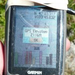
GPS recorded height: 2116 feet / 645 meters
Lat/Lon: N47.05528 W83.76377
Line Parent: Seal Lake Peak
Key Col: N47 02.049 W83 36.667 (1581ft / 482m)
Clean Prominence: 532ft / 162m
Date Summited: August 14, 2011
Overview:
North of Ranger Lake in a remote corner of the Algoma highlands, Witchdoctor Lake Peak is one of three virtually unknown high points. It is thus named because of its close proximity to the lake bearing its name. There are no trails to the summit, however it can be hiked in a day by bushwhacking from one of the nearby logging roads in the area.
Directions:
Click here for directions from Sudbury to nearby Gravel Lake. From Gravel Lake, follow Domtar Road west until reaching the junction with Laughing Lake Road, 1.8 km past Gravel Lake. Keep right on Domtar road which travels northwest along the shore of Tujak Lake. When the road veers right, 7.8 km from the junction with Laughing Lake road, park at the small pull off at the start of an ATV trail. From this parking area, it is a 3.0 km (as the crow flies) bushwhack westward – 256 degrees magnetic heading to the summit of Witchdoctor Lake Peak. The bushwhack begins steeply but then flattens out and passes through deciduous and then mixed forest. 1.3 km from the parking area, you will pass by the northern edge of a marsh which must be crossed. There is another marsh crossing 500 meters beyond, 1.8 km from the parking area. After the 2nd marsh, the route climbs slightly until reaching the partially open summit of Witchdoctor Peak, 3.0 km. The highest point is atop a moss covered bald rocky ledge. There are partial views to the west about 50 meters west of the summit.
View a larger version of the map
Trip Summary:
0.0 km – Parking on Domtar Road / Road to Witchdoctor Lake
0.8 km – Small creek crossing
1.7 km – Marsh 1 crossing
2.3 km – Marsh 2 crossing
2.5 km – Overgrown trail
3.9 km – Witchdoctor Peak summit
Trip Report:
Terry and I awoke to a cool, yet beautiful sunny morning; a dramatic change from the previous day’s trek to Seal Lake Peak. We had pitched out tents in an old gravel pit near the shore of Gravel Lake and as the sun’s rays cleared the tree tops at the edge of the clearing, the dew covered grasses glistened in the sunlight. We had a decided on a late start for the day, as we were hoping the sun would dry out the forests, which were soaking from the previous day’s rain. As we drove out along Domtar Road, we noticed the campsite near us, situated picturesquely on the shores of Gravel Lake now had occupants. We waved as we drove by and decided after our day’s excursion we’d pay them a visit and introduce ourselves.
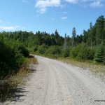
As we drove up Domtar Road along Tujak Lake, we passed a small village of trucks and trailers parked up and down both sides of the road, with the ‘village’ residents out and about — A nice way to spend a a couple weeks of summer. After exploring the area south of Witchdoctor Lake, we discovered yet again that many of the roads on the OBM maps no longer exist. This forced us to consider a secondary route to the Peak, and we backtracked down Domtar Road to a bend in the road where an overgrown ATV path diverged.
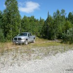
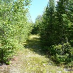
We pulled off the road onto the ATV trail landing, parked the truck and then headed up the ATV trail which we thought would put us in a better position for the long bushwhack to Witchdoctor Peak. The ATV trail turned out to be so overgrown with thick tag alder, that we decided to return to the parking area to reconsider our route. From the parking area along Domtar Road, we could trace a westerly heading on the map which skirted the northern edges of 2 lakes and ascended the eastern slopes to the summit of Witchdoctor Lake Peak. We decided to go for this and began our 3.0 km bushwhack.
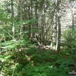
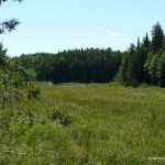
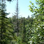
After an initial steep ascent up through hardwood forest, the route flattened out and gradually descended towards a small and easily crossed creek. The forest transitioned to thicker mixed coniferous/deciduous forest which made for more difficult passage. After another 30 minutes, the thick bush gave way to a clearing/marsh which occupied the northern edge of a small lake. We paused for a short break at the edge of the clearing and enjoyed the warm and sunny weather.
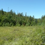
The marsh, although wet and muddy in spots was not hard to cross. At the western edge, we encountered a small stream which we were able to cross atop a fallen tree. We reached the western edge of the clearing and plunged back into the bush where we began an ascent up another hill. After a short bushwhack through mixed forests, we arrived at a second clearing with a marsh. Again, this marsh was not too wet and we were able to cross it fairly easily. A creek ran along it’s western edge which we were able to jump across without much difficulty. From this point onwards, the bushwhack was a moderate ascent up to Witchdoctor Peak.
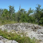
Along the way we saw evidence of logging in the distant past: large exposed stumps dotted the landscape, with the occasional tree which had obviously been cut with a saw – left to rot in the forest. The ascent steepened until giving way to the thinly forested summit area. After 2.5 hours / 3.8 km of bushwhacking, we arrived at a large lichen covered rock which we figured to be the highest point.
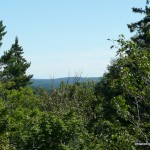
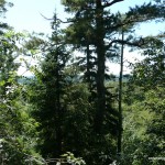
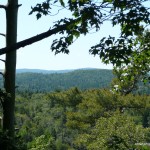
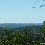
I hiked a hundred meters west and found some descent views of the hills to the south and west. I figured one must have been Ogidaki, the highest peak in the Algoma region, but unfortunately I wasn’t able to identify it.
After a lunch break at the summit, we began the trip back down by retracing our footsteps and referencing our GPS track. At one point, we accidentally diverged south from the track and discovered an overgrown road which seemed to be headed west into the second marsh area.
After a 2 hour 20 minute descent, we arrived back at the truck without incident. We made our way back down Domtar Road, past the trailer village at Tujak Lake, and returned to our campsite on Gravel Lake. After some relaxation and refreshments, we headed down the road to chat with our new neighbours. We met Bushmoose (who posts regularly on the Ontario Out Of Doors magazine online forum) and his wife who were up in the area to camp and do some fishing. We enjoyed good conversation: our stories of peakbagging Witchdoctor and Seal Lake Peak, and their detailed knowledge of fishing and camping in the area – all while savoring some of Bushmoose’s cold beer.
Witchdoctor Lake Peak GPS Track (.gpx format)
Related Links:
Witchdoctor Lake Peak on peakbagger.com
A great adventure, lots of great memories. Thanks Derek!