Carson Creek Peak
Posted by Derek on Sep 3, 2009
Rank: 4
Height: 2198 feet / 670 m
GPS recorded height: 2217 feet / 675 m
Lat/Lon: N48 21.283 W90 00.793
Line Parent: Tower Mountain
Key Col: N48 20.675 W90 01.146 (1969ft / 600m)
Clean Prominence: 229ft / 70m
Date Summited: August 20, 2009
Overview:
Carson Creek Peak is the name given by Brian Back of OtterTooth.com to the fourth highest summit in Ontario. The peak is the second highest point atop a ridge which runs northeast from beyond Tower Mt. and the summit is marked by the Aldina fire tower. Carson Creek Peak is the highest road accessed peak in Ontario.
Directions:
From Thunder Bay, drive west on Highway 11, and about 4 km before Kakabeka Falls, turn left onto 588 to Stanley. Follow 588 for 35 km through Stanley and Nolalu to the turnoff onto North Sideroad 1.6 km (1 mile) past the junction with Route 593. Follow this well graded dirt road for about 6 km to the intersection with Delints Road. At this point the road jogs left and than immediately right and continues northward in somewhat rougher condition. Keep left at forks at 6.7 km and 8.2 km. After this point the road turns west, and eventually heads south and crosses a small stream at 12.9 km. At 13.7 km, take the right fork and 300 m beyond at the 14 km mark, is a good spot for parking. The road beyond this point continues to get rougher so those with low clearance and 2-wheel drive vehicles should park here. The peak is still 5.9 km away, but it climbs gradually and the travel is entirely along 2-track roads.
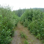
17.5 km from 588 (3.5 km from the parking spot), a quad path to Carson Creek Peak branches to the left. The trail heads west –although overgrown it is fairly easy to travel. The trail rounds the mountain to its southern flank and begins to climb gradually northward up to the broad summit. At N48 21.156 W90 00.776, another overgrown track enters from the left which must be taken to complete the remaining 380 m to the Aldina fire tower and the summit.
Carson Creek Peak is a broad and flat summit and covered by dense bush. However, the spot directly under the tower appears to be the high point of land on the summit. The track continues past the summit and down the north side of the mountain and may eventually loop back with the incoming road at N48 20.979 W89 59.904.
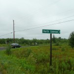
00.0 km – Turnoff onto North Sideroad from 588
06.0 km – Intersection with Delints Road
06.7 km – Keep left at the fork
08.2 km – Keep left at the fork
13.7 km – Go right at the fork
14.0 km – Parking for low clearance and/or 2-wheel drive cars
17.5 km – Follow the overgrown track left (west)
19.6 km – Take the overgrown track on the left (heading north)
19.9 km – Summit and Aldina fire tower
View a larger version of the map
Trip Log:
This was the first mountain on my Thunder Bay area todo list and I probably picked the worst day to do it on. That morning I departed the Pancake Bay Provincial Park campground (North of Sault Ste Marie) and drove to Thunder Bay, arriving mid-afternoon. It had been raining all day and the skies showed no signs of clearing. Determined to keep to my plan and schedule, I departed Thunder Bay after having a quick lunch and arrived at the North Sideroad turnoff on 588 at 4:20 PM.
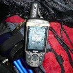
The road was in good shape and I was able to drive the 6.0 km to intersection with Delints Road fairly quickly. After the jog at the intersection, the road narrowed and the drive up slowed. Following the route I transcribed from Google Maps’ satellite imagery I navigated past several forks and finally when the road got too rough for my liking, I pulled over and parked. It was 5:00 PM and it was still raining, and I was still 6 km from the summit.
After a bit of thought I decided that I could make good time on the road in, even if it was pouring outside. I donned my rain gear and bravely set out up the road towards the peak.
The road climbed gradually and was an easy walk. I would imagine that more appropriate vehicles could easily make the drive right up to the quad path turnoff at N48 20.979 W89 59.904. Noticing several clumps of bear scat on the road, I pulled my bear bells out from under my pack cover to ensure a noisy hike for the rest of the trip.
Paying careful attention to my directions, as there’s a maze of diverging quad paths everwhere around the summit, I crept closer to my objective. With each new encounter of forked path, the more overgrown the route became. At times the trail was quite slushy and I had to dodge around some swampy bits. Always optimistic I expected to see the fire tower at the summit, but it wasn’t until I was practically on top of it that I finally got my first glimpse of it.
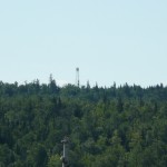
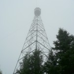
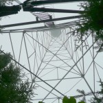
The Aldina fire tower stood before me, amid the fog and the rain. It was in great condition and I saw that the MNR had not bothered to remove the ladder up to the observation box (as is their custom). I took the usual summit photos, fighting to try to keep my camera dry, and waypointed what I felt to be the highest point on the mountain. Just in case, I followed the trail down the backside of the summit to confirm that I really was at the summit. The trail descended and did not appear to gain any elevation.
Returning to the treed summit, I didn’t bother to climb the ladder, as the fog didn’t allow much of a view and the rain would make it an uncomfortable experience. On a clear day there would be good views from the ladder, above the treeline.
Carson Creek Peak GPS Track (.gpx format)
Update:
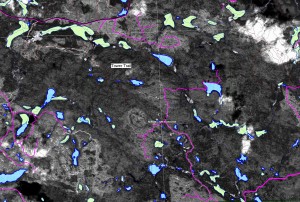
The northern route from Boreal Road is visible as a red line on this satellite image with many of the roads in the vicinity highlighted in magenta. The approximate lat/lon for the turnoff from Boreal Road is N48.378883, W90.02153.
Related Links:
Carson Creek Peak – Peakbagger.com
Aldina Fire Tower – Superior Hiking
Tower Mountain
Seems like a convoluted way of getting to the tower. Old road/trail departs Boreal Road at UTM 5362700N/720537E (NAD83 Zn16. It is about a 2.5 to 3 mile hike made more difficult to blow down.
Thanks for the information John. I converted that UTM to lat/lon: N48.378883, W90.02153. (Hope that’s correct). When I was planning my trip up to Carson Creek Peak the only information available to me was Google satellite maps, outdated topographical maps and a few local reports. The road you speak does appear on the Ontario Base Maps, but I have found that OBM has varying degrees of accuracy (with respect to road placement). Unfortunately the satellite imagery for the area around that turnoff from Boreal Road is too low resolution to show a road or trail.
The trail used to be an excellent ruffed grouse trail and I used to walk it often during the hunting season. Several years back, perhaps 7 or 8, we had a terrific storm rip thru here resulting in severe blow down of trees. Have not been up there since, although I did approach it from the south once when I went into Aldina Lake. The first part of the road has now been logged (salvage logging) but I am not too certain about the upper reaches of the trail. I always nearly died on my first trip of the year because of the grade, but got better as I made multiple climbs. Unless someone has reinstalled the first section of ladder, access to the top was restricted.
Note that Tower MOuntain north of Tower Lake in Jean Twp can also be accessed from the north via the Boreal/Marks/Raven roads.
I made an error in the UTM coordinates. It should be Zone 15 not Zone 16. Whatever you did with the conversion comes out reasonably correct. I get 48.378971 Lat/ -90.021771 Long. These were taken directly off of Google Earth. The UTM should be 720521E/5362715N in UTM Zone 15U Nad83.
[…] trails heading in all directions in this area. Make sure you have a map and compass. Thank you to OntarioHighPoints.com for the […]
I had a great time checking out the Aldina Fire tower after I’d seen it on your site. Was able to park at the start of the quad trail which shortened the hike. http://superiorhiking.com/?p=1148 Totally got lost on the drive out!
I’m not quite sure,traveling up the Boreal Rd.,there is a road on the right hand side. I believe thisroad is called Aldina Rd. I haven’t seen any tower near Upsala, so, I’m a little confused.
We have lots of radio towers and lookouts for the M.N.R and I’ve spotted most of those. There is a stop sign on the left going up the Boreal Rd., so where does that road go to? Does it go down to the other highway in Nolalu?
To get to the Boreal Rd. you turn left at Kakabeka Falls, past O’Conner Township, you can see the Boreal Rd. sign and then you turn right. Some how or other you’ve lost me by the directions you’ve given.I’d like to know more about this Aldina Lake and where that is and if it’s in the same area.We are looking for places in the area to put our trailer. All of it is crown land and resorts charge way to much for us and it’s the gas. Thanks
Sandra: The route I describe in my trip report approaches the mountain from the south and starts on the turnoff onto North Sideroad from Highway 588 just past Silver Mountain (See Map). In the comments, John mentions that that there may be a simpler route from the north via Boreal Road, but as I didn’t take this route, I can’t comment on it. However, I did see the Aldina Fire Tower from the Boreal Road a few days later on my way out to Head Lake Peak East.
A much easier way of reaching the Aldina Tower on Carson Peak, is certainly via the Boreal rd.
The directions would be take Hwy 590 to the Boreal Rd. Drive this for 21.3 Kms to where an old bush road is on the left side. Take this for .6 km and park. You can either walk or ATV from here. It is 4.7 kms to the tower on a well defined road/path (although growing in). If ATVing, make sure to watch for an almost invisible washout in the road (within the first km). At approx 2.2 km keep to the right fork.
Thanks for the directions Jane. This is a much more straight-forward route and as I learned first hand, Boreal Road is in much better condition than the roads leading to the peak from the south.
The interesting thing about the approach from the south to the Aldina tower is that there are still remnants of a logging road (and ATV trail) that lead to the top from the south. A 4-wheel drive vehicle can make the trip. Not sure that a 4WD vehicle can complete the other route from the north of the Boreal Road. But what makes this route particularly interesting is that I believe this road might just be the highest elevated road in the province, as no other higher “high point” in the province has road access leading to the top!