Ishpatina Ridge (Tower Summit) – Overland
Posted by Derek on Sep 5, 2010
Rank: 1
Height: 2275 feet / 693 m
GPS recorded height: 2298 feet / 700 m
Lat/Lon: N47 19.002, W80 44.930
Key Col: N49 32.433 W85 35.183 (981ft / 299m)
Clean Prominence: 1293ft / 394m
Summited on (Overland Route): August 1, 2010
Overview:
The Ishpatina Ridge, set in a remote corner of the Lady Evelyn-Smoothwater wilderness park, is a series of worn and rounded bumps spanning approximately 13 km. The Ellis Fire Tower, a lonely sentry and reminder of days of old, sits on the tallest of the bumps and looks out across the vast expanse of Canadian Shield wilderness. At a height of 2275 feet / 693 m, the Ishpatina Ridge is the highest point in Ontario. From a logging road crossing at the Sturgeon River, the Ishpatina Ridge can be climbed in a day by following a series of logging roads, overgrown bush roads, hiking trails and bushwhacks.
Directions:
There are 2 routes to the Ishpatina Ridge:
- The traditional and most common route begins as a multi-day canoe trip up the Montreal River, over a series of lakes and portages between Smoothwater Lake and Scarecrow Lake and ends with a hike up to the summit via an old fire tower watchman’s trail.
- More recently, many hikers have begun to use an overland route accessed via a series of logging roads which are accessed north of Capreol (near Sudbury). Most hikers begin on foot or by bike at a rugged road crossing of the Sturgeon River and follow the road north to a series of overgrown bush trails. Combined with a bushwhack along the west shore of Scarecrow Lake and the usual fire tower trail hike from the trailhead on Scarecrow Lake, many hikers are able to complete the trip from car to car in a long day hike.
Click here for my trip report to Ishpatina Ridge via the Montreal River (traditional canoe route)
Directions to the Ishpatina Ridge via the overland route is as follows:
From the Sudbury area, make your way to Garson either via the Falconbridge Highway (RR-86) or the Garson/Coniston Road (RR-90). Take RR-85 for 18.4 km to Hanmer, and after it jogs across the train tracks follow RR-84 to Capreol which is 6.5 km ahead. Passing through the small town of Capreol, continue along the road for another 8.0 km and then turn right onto Portelance Road. It is 64.4 km from the intersection at Portelance Road to the Sturgeon River, so it would be advisable to make sure you have proper provisions before making the trip. Also, the road may have active logging in progress, so caution is advised — give the logging trucks a lot of space.
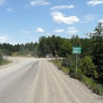
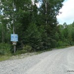
The first 5 km of the dirt road is fairly wide and well traveled by the residents of the Wahnapitae First Nation Reserve. The road forks at the Wahnapitae First Nation Reserve sign. Take the left fork and proceed along the road which runs in a north-northeast direction for 15.5 km until meeting up with the Wanapitei River. Do not cross the River at the bridge here, but continue along the west shoreline of the River for another 5.3 km. 20.8 km from the turnoff at the Wahnapitae Reserve, the road crosses the Wanapitei River and follows the eastern shore of the river for another 8.8 km until Stobie Road forks to the right. Cars with low ground clearance will have to be cautious as sometimes the gravel can pile up in the center of the road. Turn right (east) onto Stobie Road and follow the road eastward.
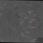
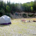
After 5.7 km, the Gervais Road which travels 24 km to the south shore of the Sturgeon River, branches to the left. Following the Gervais Road north, turn left at the forks at 9.2 km and 14.1 km from the intersection with Stobie Road. The final 15 km of road, although quite rough, are still passable for cars as long as caution and common sense are used — drivers should be prepared to drive 20-30 km/h. The Google satellite imagery for the northern half of the Gervais Road is not up to date (as of September 23, 2011) — please see the attached satellite imagery from geobase.ca to see the new extension to Gervais Road.Just before reaching the Sturgeon River, there is a large flat area (old gravel pit) which can easily handle group camping. There is also a smaller campsite right at the river. If camping within 120 meters of the Sturgeon River, a back country pass will be required.
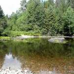
In most situations it should be possible to wade across the Sturgeon River, however strong currents in combination with high water levels can make the crossing hazardous. After crossing the Sturgeon River, stay on the main gravel road north. This road can easily be biked, and if attempting to hike the Ishpatina Ridge and back in a single day, it is recommended to bring a mountain bike for this section.
5.1 km from the Sturgeon, the road fords a small stream which connects Little Scarecrow Lake and Hamlow Lake. However, there is a small makeshift log bridge just east of the road, which crosses the stream. The road skirts the eastern shore of Stull Lake and 1.4 km from the makeshift bridge, an overgrown bush road branches to the right. If on a bike, stash the bike near the intersection here and follow the overgrown bush trail on foot.
Follow the bush path north for about 290 meters and turn east on another bush path which branches to the right. Follow this path eastwards for 570 meters until reaching another fork — take the left fork. The trail past the fork, although marked with flagging tape and blazes, quickly becomes overgrown and passes through some marshy areas. Initially the overgrown trail travels east, but after 0.5 km, the trail turns north. After another 0.5 km, the trail swings right (east) and continues for 0.5 km until terminating. The remaining distance to the Ishpatina trail trailhead on Scarecrow Lake must be bushwhacked. The Ishpatina Ridge Trail trailhead lies 2.5 km (as the crow flies) away from this point. From the end of the bush trail, bushwhack 85 degrees (magnetic north) for 900 meters to the shore of Scarecrow Lake — stay along the southern edge of the hills along the route, as there is no need to climb them. Note: As of September, 2010, the trail has been extended for 1 km to Scarecrow Lake and along the west shore of the lake, cutting the bushwhack to 1.5 km.
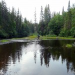
If water levels are low on Scarecrow Lake, it may be possible to save time and energy by walking along the rocky shoreline. Occasionally, one will have to swing back into the bush to avoid blow-down and/or marshy areas. There is also a a fairly well established animal path along the lake edge. Once reaching the northwest shore of Scarecrow lake, the bushwhack ends at a well-established campsite and the start trail to the Ishpatina.
The 3.7 km trail to the Ishpatina Ridge – Tower Peak begins at the canoe launch on Scarecrow Lake and ascends through an area regenerating from a recent bush fire — wild raspberries and blueberries are abundant here. The trail skirts a small lake and begins a moderate ascent northwards. About 1.7 km from Scarecrow Lake, the trail passes through a lowland marsh near a second lake along the trail. Logs and wood planks have been layed along the trail to make the passage across easier. Once traversing the marsh, the trail begins to climb more steeply for 0.7 km.
2.4 km from Scarecrow Lake, the trail gains the top of a ridge. This would be the most advantageous place to start the bushwhack to Ishpatina’s South Peak. The trail then descends slightly to Dick Lake, the third and final lake on the route to the summit.
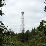
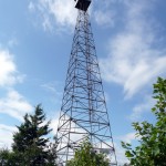
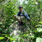
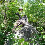
Crossing an overgrown beaver dam at the east edge of Dick Lake, the remaining 1.1 km of trail ascends almost 500 feet to the summit. Closer to the top, the firetower at the summit will come into view. A large boulder hidden by thick bushes at N47.31670 W80.74884, 50 meters from the base of the tower may be the highest point on the summit. At the base of the tower, there are good views towards the North and South peaks.
*Last update: September 23, 2011.
Trip Summary:
00.0 km – Turn onto Portelance Road from RR-84
05.0 km – Turn left at the fork at the Wahnapitae First Nation Reserve sign
20.7 km – Road reaches Wanapitei River, stay on the west shore of the river
25.8 km – Road crosses the Wanapitei River at Fraleck Bridge. Road continues along east shoreline
34.6 km – Turn right onto Stobie Road
40.3 km – Turn left onto Gervais Road
49.5 km – Turn left at the fork
54.4 km – Turn left at the fork
64.4 km – Gravel pit camp near Sturgeon River
00.0 km – Ford Sturgeon River and hike/bike along gravel road
06.7 km – Turn onto overgrown bush road
07.0 km – Turn right onto bush road #2
07.5 km – Take left fork onto overgrown trail
09.0 km – End of the trail, beginning of the bushwhack to Scarecrow Lake
10.1 km – Scarecrow Lake – hike along shoreline to Ishpatina Trailhead
12.3 km – End of bushwhack, beginning of the Ishpatina trail
15.0 km – Ishpatina Ridge – Tower Peak
View a larger version of the map
Trip Report:
Even though I had previously climbed the Ishpatina Ridge – Tower Peak on a canoe trip starting from the Montreal River in the north, I had always wanted to attempt the trip like many others sans canoe. What held me back was the condition of the Portelance Road beyond the Wanapitei river. There was no way I could take my Grand Am up that road! It was therefore a big surprise for me when I read about the new Gervais Road which replaced the old Portelance Road between the Wanapitei and Sturgeon Rivers. I had to try this route and if that wasn’t reason enough there was still the matter that I had not climbed Ishpatina’s South Peak yet.
After exchanging emails with Brian Back of ottertooth.com and Ralph Schuessele who organized a Geocacher event to Ishpatina in October of 2008, I had enough information to plan my trip. Now I had to find someone keen enough to join me on this crazy adventure. After a couple of line up changes, my friend Darcy mentioned he would be interested in going. He insisted we bring a satellite phone, which was probably a good idea considering I had had some car troubles a few weeks earlier with my aging Pontiac that would have to traverse the 65 km of rough logging roads.
The plan was to meet up in Barrie and drive up together to Sudbury and gas up. Then continue north past Capreol to the turnoff onto Portelance Road, travel 65 km along narrowing logging roads and finally make camp at the Sturgeon River. We had the 3 day August long weekend to complete the trip; 2 days for driving up and back and 1 day for the hike to the South and Tower Peaks of the Ishpatina Ridge.
We left from Barrie, Saturday morning, just after 7 AM and traveled north along Highway 400 and 69 to Sudbury. Even with a short delay at the Key River (bridge narrowed to one lane for construction), we arrived at the turnoff onto Portenance Road at 1 PM.
The road, although gravel was quite wide and smooth and we made quick time (60-70 km/h) up to the turnoff onto the Wahnapitae First Nations Reservation. Past the Reservation turnoff, the road narrowed and we slowed down a bit (50 km max) as we had to be more vigilant looking for oncoming vehicles, especially logging trucks. It wound cross-country until finally arriving at and crossing the Wanapitei River.
Paralleling the eastern shore of the river, the road continued north. The road was still in good condition, however at a couple sections, the gravel was piled up so high between the 2 tire ruts that my car’s undercarriage would plow into it, giving me a bit of a startle.
About 50 minutes into our drive along the logging roads, we arrived at the turnoff onto Stobie Road. We followed the road east for about 10 minutes, until reaching another turnoff onto an unmarked road, I assumed to be Gervais Road. We followed Gervais Road, slowing our speed as the road narrowed and became rougher. Luckily we never encountered any logging trucks because I’m not sure where we would have pulled off to let them by.
Along the way we took a couple wrong turns, as the roads that diverged looked to be the main road. We quickly found this out and managed to turn around and back up and continued on our way. The last 15-20 km of the road were the roughest, and the fastest I could safely drive was 15 km/h.
After 2 hours of driving along the multitude of logging roads, we arrived at the gravel pit, just shy of the Sturgeon River. We made camp, explored the area a bit, scrounged for wood and walked down to the river to investigate the water levels. As we suspected, water levels were way down. With sandals/water shoes we could easily walk across the river along a crest of gravel and rocks.
With no bugs to bother us, we enjoyed our suppers around a blazing fire and went to bed just as dusk was upon us. Tomorrow was going to be a long day and we wanted to be up at a good time.
We awoke the next morning at 6 AM to a bright, but slightly overcast day. The weather reports forecasted for some rain, but as luck would have it, it would never come. After eating breakfast and making last minute preparations, we set off up the road towards the Sturgeon River. In the interest of saving time and daylight, I decided that we would bring our bikes to ride the 6.7 km of road beyond the river.
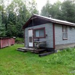
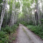
The river crossing was a non-issue. We had changed into crocs/sandals for the crossing, but I must admit that except for a few spots, we probably could have safely crossed in our hiking boots. The road beyond was in good shape for mountain biking and even the hills were gentle, which I appreciated. Along the way we encountered an old cabin, that was obviously still used occasionally. We biked along beautiful birch-lined sections of road and eventually arrived at the creek running between Hamlow Lake and Little Scarecrow Lake. I had read about a bridge off to the right-hand side, so we backtracked to a short side trail, crossed a makeshift log bridge and saved ourselves another water crossing.
Just over a kilometer from the bridge, we reached the end of the 6.7 km section of road, and turned off onto a more overgrown bush road. We ditched the bikes as planned just off the trail in the dense bush — there wasn’t a soul around but we figured we’d hide them just in case.
Continuing on foot, we hiked north for a short while, and then took a right turn onto another similar bush road. This road was still easy to follow as it headed east. Only 800 meters into the hike, we arrived at a fork in the road which confounded us for a minute. I was pretty sure we had to take the left fork, but just in case I hiked a bit along the right fork, which headed south — the wrong direction, into a marsh. Backtracking to the fork, we confidently took the left fork onto a narrow and overgrown trail.
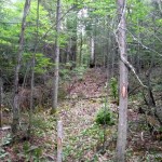
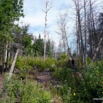
This trail was marked with various coloured flagging tape and some of the trees were blazed to mark the way. Initially heading east, the trail then swung north and passed through some marshy areas. A short while later as the trail neared a small unnamed lake, it swung east again and terminated at a group of trees liberally marked with flagging tape. We had to bushwhack the remaining 2.5 km to the Ishpatina trailhead on the north shore of Scarecrow Lake.
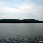
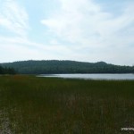
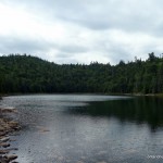
As we knew the water levels in the area were low, we decided to bushwhack towards Scarecrow Lake in the hope that we could walk along the shoreline and save time and energy. Following a bearing of 73 true / 84 mag degrees, we descended along the edge of some steep hills until leveling out at the bottom. After about 30 minutes of bushwhacking, we escaped the dense bush and arrived at the shore of Scarecrow Lake, just north of a little peninsula which jutted out onto the southwest edge of the lake.
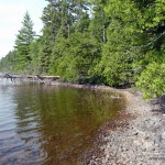
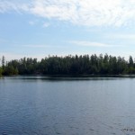
Much of the southern shoreline of Scarecrow Lake was comprised of small boulders which allowed us to follow the coast for most of time. The total bushwhack distance ended up being about 3.3 km instead of 2.5 km, as we were following the contour of the lake and had plunge back into the thick woods to avoid obstructions along the coast. We didn’t mind the extra mileage, especially as we walked across the occasional sandy section instead of struggling against branches and fallen trees along the animal paths which paralleled the edge of the lake.
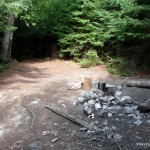
After only 50 minutes of rock hopping and walking along the shore of Scarecrow Lake, we arrived at the campsite just south of the Ishpatina trailhead. We stopped here for a bite to eat and I filtered water for the trip up the mountain.
We left the campsite and quickly arrived at the trailhead. The area at the start of the trail was fairly open as there had been a small bush fire here, but nature was returning: wild raspberries and blueberries were everywhere. We climbed a small hill and made our way to the first lake on route. We encountered a trail branching to the right which led down to the lake, but we kept to the left fork which brought us over large boulders along it’s west shore. The trail was easy to follow except for the occasional blow-down requiring us to go around.
We soon came upon a marshy area near the second lake along the trail. Someone had placed logs and boards in key places so we were able to get across without getting wet or muddy. Past the marshlands, the trail began to climb more steeply. Since it had gotten hotter as midday approached, this was thirsty work.
Once we gained the top of the ridge near Dick Lake, we took another breather. This was the point at which we would diverge from the trail and bushwhack west to the South Peak of Ishpatina. Click here for my trip report to Ishpatina – South Peak.
We arrived back at Dick Lake at 2:10 PM after bushwhacking to the 2 potential high points on the South Peak. After a quick break, we resumed the final 1.2 km up to the Tower Summit of Ishpatina. The trail climbed at a moderately steep pitch, but after about 20 mins we got our first glimpse of the fire tower at the summit. After another 5 minutes, we reached the summit. It was 2:45 PM. With the side trip to the South Peak, it had taken us 8 hours to reach the summit.
I had read reports that indicated that a large boulder just southeast of the summit was actually the highest point, so Darcy and I went to check it out. My GPS measurements were inconclusive, so we decided to take summit photos.
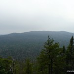
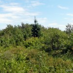
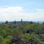
The views from the base of the fire tower were impressive. We were able to see the South Peak where we had been hours earlier as well as the rugged cliffs of the North Peak where my father and I had been earlier in May.
After spending about half an hour on the summit, we began our trip back. I had run out of water, and decided to skip filtering water from the little ponds and lakes on the way down in favour of filtering water from possibly cleaner source: Scarecrow Lake. I raced down the 3.7 km trail in just over an hour and refilled my water bottles. As I was enjoying the filtered lake water, I was rejoined by Darcy.
The trip back was uneventful as we retraced our steps back along the Scarecrow Lake shoreline, back up the 900 meter bushwhack to the flagging tape markers that signaled the start of the bush trail back to the gravel roads.
After a small mix up we found our bikes just off the bush road in the woods and started biking back. After a short while, we heard an ATV approaching and saw the first sign of life we had seen all day. A couple in a ATV passed us driving south along the gravel road. We exchanged greetings and they continued on past.
When I reached the Sturgeon River, I changed into my crocs and made the crossing. It was only a few hundred meters further to our campsite. A few minutes later, Darcy reached the river’s edge. He opted to not change out of his boots and walked his bike right across, soaking his feet in the process. In another 2 minutes we would be back at the campsite.
It was 7:45 when I rolled into camp. It had been a long, but exhilarating day. We unwound with a few beers, made supper and started a fire. As dusk was approaching a minivan roared past us on it’s way to the Sturgeon River. A short time later a man walked by and introduced himself as Brian Back — what a coincidence! We had a nice discussion about our hike and the work he had done to promote and document the route we had just taken. He was planning to canoe down the Sturgeon to Solace, but would be returning to hike to Ishpatina later in the week. As night descended we wished him success and we retired to our tent for some well earned sleep.
We slept in the next morning and opted to skip our oatmeal in favour of a proper breakfast in Sudbury. We packed up, began our 2 hour drive back out the logging roads. We pulled into Sudbury mid-morning, just as it started to rain.
Darcy’s video montage of our journey to the South and Tower Peaks of Ishpatina Ridge:
Direct link to the video on YouTube
Ishpatina Overland Ridge GPS Track (.gpx format)
Related Links:
Andrew Lavigne’s trip report to Ishpatina via the overland route
Ken Takabe – pioneer of the overland route to Ishpatina
Overland to the summit (Ottertooth.com)
Road access to the Sturgeon River (Ottertooth.com)


[…] best description of how to go in seems to be this one from OntarioHighPoints.com. I did basically what they said, however, there are a few points that should be […]
Just wanted to thank you again for this site! Went in and as I said, this seemed to be the best resource I’ve run into, and it was very much appreciated that you took the time to write this, and update it.
I wish this write up had been available when I did my trip in 2010.
Thank you for the updates on the conditions that have changed since I did the trip. I will be going again in the spring of 2012 with as a guide to a few that want to do the trip, but never have.
I have put together a resource thread about Ishpatina Ridge and all the resources I have found about traveling there and the area. The thread can be found on the Northern Ontario Geocacher’s forum. The thread can be found here; http://forum.northernontariogeocachers.com/viewtopic.php?f=12&t=487&p=1798
If you would like to add more info to my thread, please go ahead.
Mike
Some great information here, just an update from May 28, 2016.
– A lot of the trail shortly past the no bike portion is overgrown or covered with dead fall, it is relatively well flagged but easy to get off track in some locations.
– It is early in the season but the water level at the start ranged from knee to waist depending where you crossed.
– The bridge crossing at little scarecrow is no longer there so expect to get wet again (knee deep).
– Overall it took me about 5.5 hours to “summit” and 4 hours out with a 55 lb training pack (just there to add weight). planning for 10 hours of hiking should be sufficient without bikes.
Just used your instructions. Just wanted to let everyone know the logging trails have clearly been redone and can be done by any vehicle.
(Ps. You cannot leave from North Bay and head north and cut across to meet up to these instructions lol. Best bet is set your GPS for Capreol.)
just wondering is the Ishpatina Tower still standing
hello again . I am thinking of going to Sudbury next week, maybe attempt to reach the highest peak in ontario. however I only have a car and want to limit my time driving on gravel roads or anything sketchy
i am a cyclist and have good mt bike and a fat bike is it possible to park the car at
intersection at Portelance Road to the Sturgeon River,
and bike to the summit, would most of the journey be ok on bike, or would i end up hiking later on.
being october, would you recommend?
and can i do this all in one day while staying in sudbury
or where would you recommend in staying, don’t have a tent. thanks
Hi Jay, what do you mean by “intersection at Portelance Road to the Sturgeon River” ? If you mean the intersection of RR-84 and Portelance Road, it is 64.4 km to the Sturgeon River. After the Sturgeon River, it’s still 15 km to the summit. You can only bike the first 7 km or so of quad trail, after that there’s a bit of a hike along overgrown roads and then a 3.5 km bushwhack to the base of the mountain at Scarecrow Lake and then a 3 km hike up along a rugged trail to the peak. It’s a full day of biking/hiking just from Sturgeon River, so I would not advise adding additional km’s to the hike, especially in October now that daylight hours are getting shorter.
So we tried to get to the ridge in July, but the universe told us to try another day (LONG story that involves car troubles, weather troubles, bug troubles and broken equipment!). Anyways, just past the Sturgeon River is the shack on the left…then that gravel road you’re currently on turns right and a smaller path continues straight. Confirming that you hook right and stay on the gravel road, correct? We are going to try again in 2018.
It’s been awhile since I’ve been up there. I don’t recall any smaller path near the shack. Looking on Google Maps, the main gravel road, curves to the left (swings north) just past the shack. This is the road you want. Best to load my GPX file onto a GPS/Smartphone and follow it. Can anyone who’s been to Ishpatina most recently chime in ?
hi again thanks for all ur help. would mid june be a good time to try ontario highest peak%?
i have no canoe. but think to hike this prob solo
is over nite camp recommended
is route lots of bush whack?
thanks
just curious what would be the closest town to the hike, other then sudbury to stay over night would Capreol have any accmodations