Maple Mountain
Posted by Derek on Jul 18, 2009
Rank: 17
Height: 2106 feet / 642 m
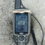
GPS recorded height: 2116 feet / 645 m
Lat/Lon: N47 23.225/W80 20.097
Line Parent: Ishpatina Ridge (Tower Summit)
Key Col: N47 28.178 W80 23.024 (1211ft / 369m)
Clean Prominence: 895ft / 273m
Date Summited: July 13, 2009
Overview:
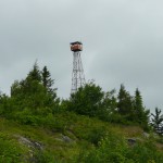
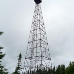
Maple Mountain is located within the Temagami region’s Lady Evelyn-Smoothwater Provincial Park. One of the best known mountains in Ontario, it’s vertical rise over the surrounding landscape: approximately 1150 feet is one of the highest in the province. Because of this, it is often mistaken as being the highest mountain in Ontario, however Maple Mountain is actually ranked seventeenth. A 100 foot intact fire tower stands on the summit and can be reached via A 3.3 km long hiking trail.
The indigenous Temagami First Nation called the mountain Chee-bay-jing, which means “the place where the spirits go” and considered it a sacred site. The mountain was named by Dr. Robert Bell of the Geological Survey of Canada in 1888. Bell was the first known non-aboriginal to scale the mountain.
Directions:
Maple Mountain is a popular canoeing destination and as such, there are many canoe routes to the mountain. The most direct route is from Mowat Landing, through Lady Evelyn River and Lady Evelyn Lake to Sucker Gut Lake and up through Hobart Lake to the trailhead on Tupper Lake. It is 40+ km paddle from Mowat Landing to the trailhead on Tupper Lake and there is only one short portage over the Mattawapika Dam right at the start. The trail from Tupper Lake to the summit is 3.3 km long. Lady Evelyn Lake can often be rough and windy and this must be considered when planning a trip to Maple Mountain. Most canoeists take 2 days to canoe to Tupper Lake and overnight at one of the many campsites along the way on Lady Evelyn Lake. Motorized boats are allowed and are often seen in Lady Evelyn River, Lady Evelyn Lake and Sucker Gut Lake, however Hobart and Tupper Lakes are off limits to them.
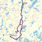
Route from Elk Lake
Some enthusiasts have been looking at an overland alternative to the standard canoe route. From Elk Lake there is a possibility to use the Cooke Lake Road and a series of old logging and bush roads to get to Anvil Lake or even further south. A southerly bushwhack from the bush road would be required to intercept the Maple Mountain trail leading from Tupper Lake. See their video log here
The first 21.5 km from Elk Lake along Cooke Lake Road is most likely navigable, even for passenger cars, but when the route turns onto a smaller and rougher road that branches to the left (east), most will be forced to park here. The next 24.5 km to Anvil Lake and beyond is most likely only suitable for 4×4 vehicles and mountain bikes. At the most southerly point of the maze of bush roads, it is a 3.5 km bushwhack to the Maple Mountain trail.
View a larger version of the map
Trip Log:
This year I was determined to get to the top of Maple Mountain. But in order to do this, we would have to canoe the 40+ km from Mowat Landing, through Lady Evelyn Lake to Sucker Gut and Hobart Lakes and finally on to the trail head on Tupper Lake.
Lady Evelyn Lake should really be considered 2 lakes, an eastern and western lake, divided by the Obisaga Narrows. After the Mattawapika Dam was completed, the water levels rose and flooded much of the lowlands and expanded the shoreline of the eastern lake. Today, flooded stands of dead trees and logs hidden just below the surface serve as a reminder of the old shoreline. The east-west orientation of the eastern lake often aligns with the westerly wind and makes the lake notoriously rough and wavey.
During our attempt the previous year, Val and I encountered the wrath of Lady Evelyn Lake and had to abort. It was then that we decided that since neither of us were canoeing enthusiasts, we would get an outboard motor for our square-stern canoe. I ended up purchasing a little old 4 horsepower Evinrude Lightwin motor for it, which works great, able to push the fully loaded canoe up to 12 km/h. Motorized craft are allowed into the Lady Evelyn-Smoothwater park boundaries, up to Sucker Gut Lake. Lakes like Hobart and Tupper however, are off limits.
With our final preparations made in New Liskeard, including subs for supper and gas for the outboard, Val and I made our way to Mowat Landing where we purchased our backcountry camping pass. If you intend to camp within the Lady Evelyn-Smoothwater park boundaries, a backcountry camping pass is required. It can be purchased at Mowat Landing Cottages, which is right beside the parking area.
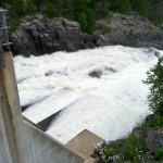
We loaded the canoe and after only 2 pulls on the cord, our new outboard sprung to life and we headed out across the Montreal River over to Mattawapika Dam. There was a line up for the boat ferry over the Dam, so we decided not to wait and carried our gear up and over the 300 meter portage. The trip down Lady Evelyn River was uneventful and we were really moving with the outboard. We were making great time and we were definitely enjoying not having to paddle.
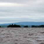
As the Lady Evelyn River opened up to the eastern lake of Lady Evelyn, the conditions changed dramatically. The relatively calm waters of the river gave way to whitecaps and wind. I had to drive the boat head on into the waves for fear of being hit broadside. As each wave hit, water poured into the canoe, pooling in the stern. I struck a northwestern path, attempting to hug the northern shoreline, utilizing the sheltered waters behind each island as an opportunity to bail out the water.
Finally, after numerous close encounters with the Lady Evelyn Lake whitecaps, we found shelter behind the inhabited Red Pine Point midway across the eastern Lady Evelyn Lake. Beyond that point, the rough whitecap waters of Lady Evelyn awaited and we were not in a mood to venture back into the fray. After a bit of discussion, we decided to head for a small island just south of the point – to wait out the weather and make camp if necessary.
Rain clouds blew in and we put up our tent, but as 5:00 PM, our go/no-go deadline approached, Lady Evelyn calmed. We decided to take advantage of the break, packed up the tent, and left our temporary island home to set off across the lake. As we approached the narrows, Lady Evelyn stirred again and the canoe soon began to fill with water from the waves crashing over the bow. I sought shelter in another small cove to bail out.
Again the rough waves began to subside and when a canoe passed by us in the opposite direction, we were encouraged to press on. Hugging the south shoreline, we passed through the narrows and into the western Lady Evelyn Lake. Unlike the eastern lake, the waters here were substantially calmer and the boat passed easily across the lake. Staying near the northern shoreline, we made it easily into the calmer and narrower Sucker Gut Lake.
After passing several occupied campsites on our voyage south through the lake, we turned onto the western arm of Sucker Gut Lake. My plan was to spend the night on the island campsite situated just south of the creek running from Hobart Lake. To our delight the campsite was unoccupied so we came ashore, set up our tent, and made a big fire to dry ourselves out. It was 7:30 PM and we had traveled 36 km from Mowat Landing.
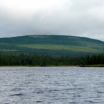
Despite the optimistic weather reports, it rained during the night and when we awoke the next morning it was overcast and drizzly. Maple Mountain, although clearly visible from the campsite was crowned by clouds and was now only a few hours away. We left our camp with only the day’s essentials and paddled north (without the outboard motor) towards Hobart Lake.
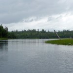
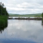
It soon became evident that the decision to disallow motorboats into Hobart and Tupper Lake was not only to protect the lakes, but also to protect the boats and their occupants. Numerous trees and rocks jutted out of the water ready to victimize any unsuspecting visitor. Hobart Lake was an easy northerly paddle across to the creek running from Tupper Lake (and Old Bill Lake), but when the creek forked to Tupper Lake, the creek significantly narrowed and a couple small beaver dams required that we haul the canoe over.
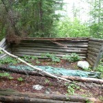
Once we reached Tupper Lake, we quickly found the trailhead to Maple Mountain among a group of trees on the southern shore and came ashore into a muddy, mosquito infested landing. We quickly put our boots on and geared up and headed up the trail, past the remnants of and old log cabin. It was just after 10:00 AM.
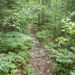
Well groomed, easy to follow, but wet from the night’s rain, I was glad to be wearing my rain gear for the trek up the trail. The trail climbed gradually to a small lake on the Mountain’s slopes but shortly after began to climb more steeply. After an hour on the trail, we reached the characteristic steep upper cliffs that crown the Maple Mountain summit. Ascending a rickety old metal ladder, we climbed onto the upper slopes of the mountain. With Maple Mountain’s open summit before us and with the elevation gain behind us we quickly reached the base of the fire tower.
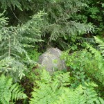
From my vantage, the true height of land appeared to be about a 100 meters to the north where a herd path passed a small boulder jutting up a few feet above height of land near the fire tower. Despite the rain and wind on the summit, we took our break and took the required summit photos. It was 11:15 AM, 3.3 km and 1 hour, 15 minutes from the trail head on Tupper Lake.
The trek back down required more care over and around the slippery, wet rocks, and especially back down the cliff ladder. As we made our way back into the canoe landing, we met up a couple youth groups on their way up the Mountain. We set off from Tupper Lake and arrived back at our camp just after 2:00 PM.
Like the previous day, Val and I set a go/no-go weather deadline to depart our campsite to try to get as far as possible on Lady Evelyn Lake. When the weather appeared to be calming just before 4:00 PM, we took a chance, packed up our camp and headed out full speed ahead onto Sucker Gut Lake.
As luck would have it, Lady Evelyn was calm enough for safe passage. Once we reached the eastern half of Lady Evelyn Lake, we elected to keep to the southern shoreline, which in retrospect was a better decision than hugging the northern shoreline on the way in. As we made our way east through the lake, Lady Evelyn began to show us her ugly side and and the waves got bigger. We took refuge behind one of the Obowanga Dunes, but until we passed around the dunes completely, we were at the mercy of the wind and white caps. Once beyond the safety of the dune islands, we had to tack the waves and dodge behind the small islands of the eastern end of the lake to make our way to the mouth of Lady Evelyn River.
Instead of spending another cold and wet night out in the park, we decided to press on up the river to make our exit at Mowat Landing. At the Mattawapika Dam, we opted to pay the $10 to have our canoe ferried over the Dam which was money well spent. It was 8:00 PM when we pulled our canoe out of the Montreal River at Mowat Landing. Between hiking, paddling, and motorizing, we had traveled 56.2 km that day.
Maple Mountain GPS Track (.gpx format)
Related Links:
Maple Mountain on Summitpost
Myth of Maple Mountain
Maple Mountain: In Depth
Memories from Maple Mountain Video Log
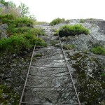
I have done this trip before, beautiful trip and beautiful scenery. Had a bit of a suprise when we had almost reached the summit to find that half of the the ladder up the rock face was not attached to the rock, half of it was laying on the ground, we found a small trail that lead us to the summit.
Had a similar problem with crossing Lady Evelyn Lake and tried to stay close to the south side. On the way back we lashed the 5 canoes together and built a sail for the way back. We took a 6 day canoe trip to complete our voyage and it was worth it.
Thanks for posting!
Does anyone know if the overland approach to Maple Mountain from Elk lake has been used? Has there been a winter ascent of the mountain?
Hi Dave,
I know that the ‘geocaching event’ group back in September approached Maple Mountain from Elk Lake via Skull Lake. They were able to drive to Skull Lake and then quaded to Anvil Lake and canoed/kayaked from Anvil Lake to the trailhead on Tupper Lake. See their video log posted above. I have not read of any winter ascents of Maple Mountain.
Hi,
I’m planing a winter ascent of maple mountain.
Can anyone offer any tips?
using the elk lake via skull lake route.
the hwy 560 to cooke lake road till it becomes impassable taking the left route on the bush road to meet up with maple mountain trail.
Hi,
I’m to do the Maple Mountain trek this summer, via mowatt landing and Lady Evelyn. Just wondering how many days it takes. I have five days planned for it, but wondering if i am being optimistic. feedback from anyone with experience would be appreciated!
Diana
Hello
In 1957 as junior Forest Ranger I manned the fire tower for one marvelous week. We had a canoe on Tucker Lake and saw bear tracks just filling with water as we embarked on a short canoe trip. We were flown in and out in a Beaver floatplane.James Van Slyck
Having grown up on that lake i enjoy reading about your trips through what was once my backyard. I can picture every tree, rock, campsite and shoreline you pass. We would run our outboards through Hobart and Tupper with no issues. We would simple turn around and back through the iffy section. Been up the mountain many times. Drank from the springs at the top and bottom. The ladder was wood as was the tower when it was manned. I remember when L&F put up the new tower. Knew all the rangers well. How time flies
hi everyone, really good post about your adventure to Maple Mountain. what would be more of an easier trek, between this one and Ishpatina Peak?
also is the Fire Tower on Maple Mountain climbable at this time?
Also is the Maple Hike more accessible, easier to navigate or what of the 2 recommend
thanks