Ishpatina Ridge (North Peak) – Overland
Posted by Derek on Sep 23, 2019

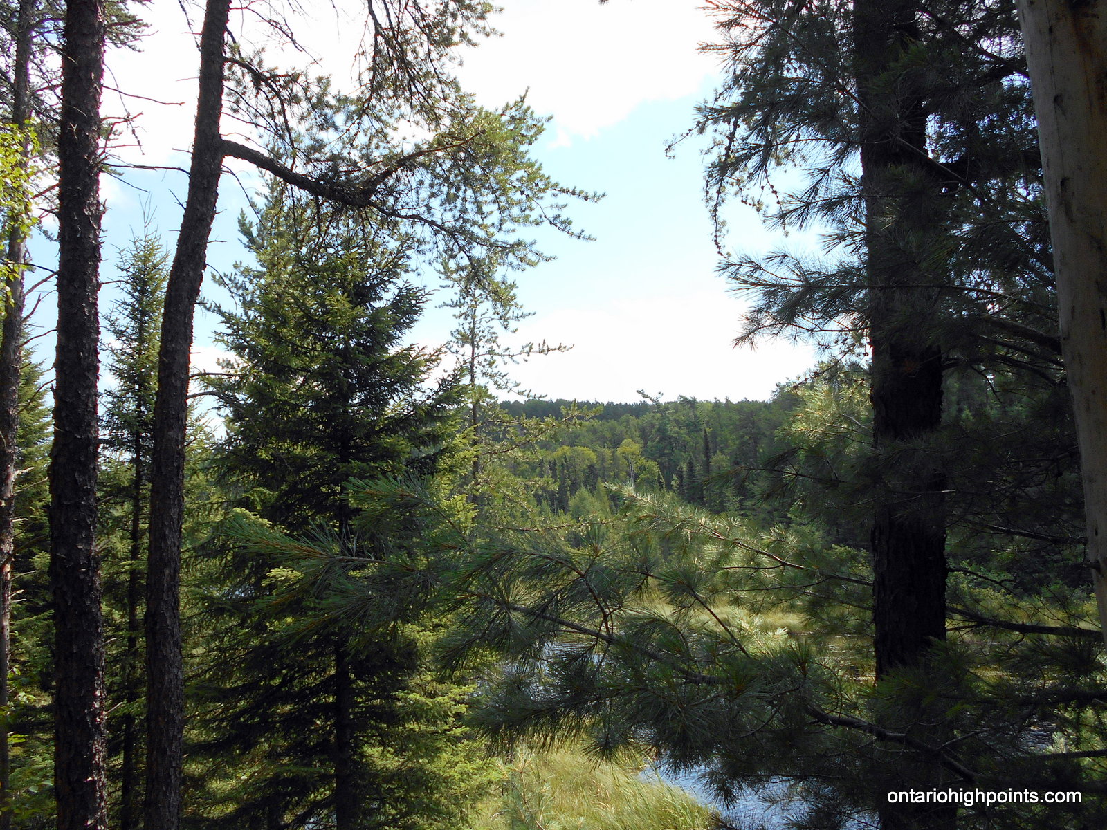
View to North Ishpatina summit
Height: 2234 feet / 681 meters
Lat/Lon: N47.333 W80.7336
Clean Prominence: 604 feet / 184 meters
Line Parent: Ishpatina Ridge (Tower Summit)
Key Col: N47 19.742 W80 44.593 (1640 ft / 500 m)
GPS recorded height: 2247 feet / 685 m
Date Summited: August 9th, 2019
Overview:
The Ishpatina Ridge traverses several rounded humps and under the Ontario 2100 Footer criteria, 3 of these qualify as being distinct 2100+ foot peaks. The familiar Fire Tower summit of the Ishpatina Ridge is the highest point in Ontario and a popular destination. It is reachable via a trail from Scarecrow Lake. The North Peak as seen from the Fire Tower summit appears to be just as high, but according to Ontario’s Ministry of Natural Resources Ontario Base Maps (OBM) series, it is 43 feet lower. There is no trail to the North Peak of the Ishpatina Ridge and the route from Ishpatina – Tower Peak is hindered by the steep cliffs surrounding the peak.
White Mountain / Lanark County High Point
Posted by Derek on Mar 27, 2018
aka. Lanark County High Point
Height: 1266 feet / 386 meters
GPS recorded height: 1270 feet / 387 meters
Lat/Lon: N45.1810083 W76.6381359
Date Summited: July 4, 2017
Ghost Range Peak
Posted by Derek on Aug 10, 2017
Height: 1601 feet / 488 meters
GPS recorded height: 1607 feet / 490 meters
Lat/Lon: N48 32.326 W79 50.106
Date Summited: July 31, 2017
Overview:
Ghost Range Peak is a 2.7 billion year old layered intrusion / sill located south of Lake Abitibi. It is the highest point in Ontario’s Cochrane District. It’s a short hike to the summit along trails that depart from a sand quarry located near the corner of Hwy 101 and Hwy 672. The fire tower that once stood at the summit was recently removed by Ontario’s Ministry of Natural Resources.
Rainy River District High Point
Posted by Derek on May 1, 2017
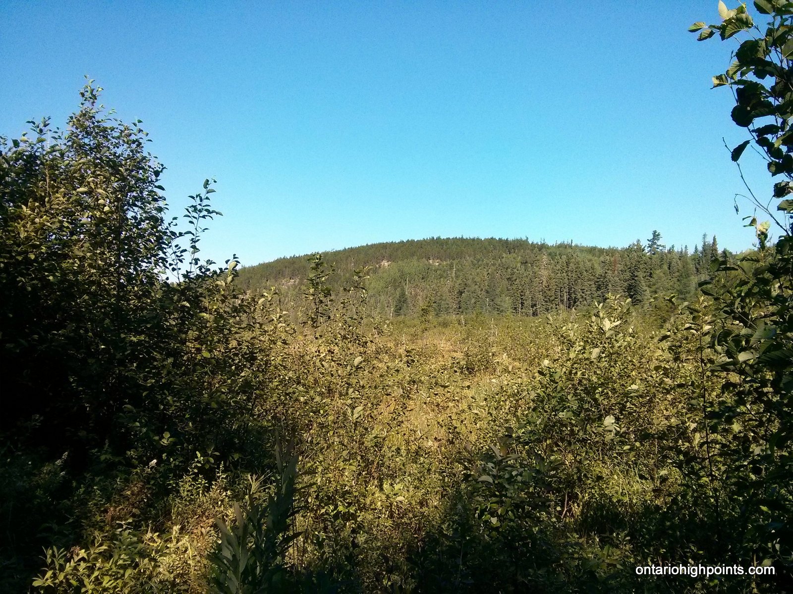
Rainy River District High Point visible between the trees
Height: 1785 feet / 544 meters
This is the elevation at the spot height. The elevation at the highest point was found to be significantly higher
GPS recorded height: 1857 feet / 566 meters
Lat/Lon: N48 09.967 W91 15.364
Date Summited: August 4, 2016
Overview:
The Rainy River District High Point is located 7 km north of the Minnesota-Ontario border in Quetico Provincial Park. Only accessible by canoe, the shortest route to the peak is from Minnesota’s Boundary Waters Canoe Area via the backcountry border crossing/ranger station at Prairie Portage. Permits are both required for the remote border crossing and to enter Quetico Provincial Park.
Kenora District High Point
Posted by Derek on Oct 30, 2016
Kenora District HP
GPS recorded height: 1860 feet / 567 meters
Lat/Lon: N49 07.165 W91 17.625
Date Summited: July 26, 2016
Overview:
The title of Kenora District High Point is shared between 2 high point candidate areas who’s elevations lie within the margin of Ontario Base Map measurement accuracy. The High Points form part of the highlands located near the head waters of the Turtle and English Rivers about 27 km southwest of the small community of English River on Hwy 17. Fishing is the dominant recreational activity in the area and access to the lakes is provided by the numerous bush trails and logging roads (active logging operations active). There are no views at the High Points, but the route passes many photogenic lakes along the way.
Parry Sound High Point
Posted by Derek on Jul 31, 2012
Height: 1745 feet / 532 meters
GPS recorded height: 1712 feet / 522 meters
Lat/Lon: N45 48.883 W79 10.119
Date Summited: July 18, 2012
Directions:
Exit Highway 11 (which now bypasses Sundridge) at Sundridge onto Highway 124 (old Highway 11) which will bypass most of the town. Turn right onto Union Road and then left onto Forest Lake Road. Follow Forest Lake Road for 8.7 km and then turn right onto Paisley Road. Follow Paisley Road for 10.8 km (turn right at 9.3 km) to an open area where you can park on the shoulders of the road. Just beyond the parking area is the ATV road turnoff on the right. The immediate area around the Parry Sound District High Point is on an “Organized Hunt Camp Area” so you should seek permission to access the properly with the owner before going and as well avoid hiking to the peak during hunting season (the fall).
Hike up the road for 1.4 km until reaching a gate. Beyond the gate is the “Organized Hunt Camp Area” property. 600 meters beyond the gate up the road is the best spot to begin the short 400 meter bushwhack to the deciduous treed summit of the Parry Sound District High Point. The highest point appears to be on a slight ridge just south from the OBM spot height.
Read the rest of this entry »
Manitou Mountain
Posted by Derek on May 9, 2012
aka. Haliburton County High Point
Height: 1847 feet / 563 meters
GPS recorded height: 1886 feet / 575 meters
Lat/Lon: N45 26.676 W78 34.962
Date Summited: May 5, 2012
Overview:
Manitou Mountain is located within Algonquin Provincial Park and is the highest point in Haliburton County. The mountain’s name: Manitou is derived from the Native American (Algonquin) word relating to the concept of spirit beings and their interconnection to nature and life.
Read the rest of this entry »
Southern Ontario High Point
Posted by Derek on Nov 6, 2011
aka. Nipissing County High Point
Height: 1896 feet / 578 meters
GPS recorded height: 1899 feet / 579 meters
Lat/Lon: N45.64877 W78.25722
Date Summited: October 2, 2011
Overview:
The ‘Southern Ontario High Point’ located within Algonquin Provincial Park is the highest point in Nipissing County and considered the highest point within Southern Ontario. Although there are various definitions of the geographic area of Southern Ontario, the Nipissing Passageway is often used as the demarcation line between Northern and Southern Ontario in provincial documents. Originally an Indian trail between Georgian Bay and the Ottawa River, the trail follows the French River from Georgian Bay to Lake Nipissing. At North Bay, the trail travels overland for 2 km from Lake Nipissing to Trout Lake. From Trout Lake, the trail follows the Mattawa River to the Ottawa River. The Preston Fire Tower once stood at the summit, but now only the footings remain.
Read the rest of this entry »
Peterborough High Point
Posted by Derek on Aug 9, 2011
Height: 1424 feet / 434 meters
GPS recorded height: 1434 feet / 437 meters
Lat/Lon: N44.85442 W78.18550
Date Summited: August 5, 2011
Directions / Trip Summary:
0.0 km – Turn off HW 28 onto Eels Lake Road
1.1 km – Turn left onto West Eels Lake Road
6.6 km – Roadside parking at turn off to Fire Route 72
0.0 km – Take left fork onto Fire Route 72
0.1 km – Turn left onto Dirt / ATV road
0.5 km – Proceed south along rougher ATV path (right and quick left)
1.1 km – Turn left onto overgrown ATV trail
1.3 km – Bushwhack last 60 meters east to summit
1.4 km – Summit with clearing.
Evergreen Mountain
Posted by Derek on Aug 9, 2011
Height: 1368 feet / 417 meters
GPS recorded height: 1374 feet / 419 meters
Lat/Lon: N45.13832 W76.91666
Date Summited: August 8, 2011
Directions / Trip Summary:
00.0 km – Optional Parking on Mountain Chute Road, proceed to Hunt Camp Lane
01.5 km – Optional roadside parking
03.9 km – Last place to park for automobiles. Turn left onto ATV path leading to Carleton Fish and Game Camp
07.0 km – Continue on ATV path beyond Carleton Fish and Game Camp to Little Green Lake
07.1 km – Turn Left at the forks
08.2 km – Turn Left at the forks
10.1 km – Turn Left at the forks / Sullivan Lake
10.8 km – Option to diverge from the ATV path at open rocky ridge
11.6+ km – Evergreen Summit and views