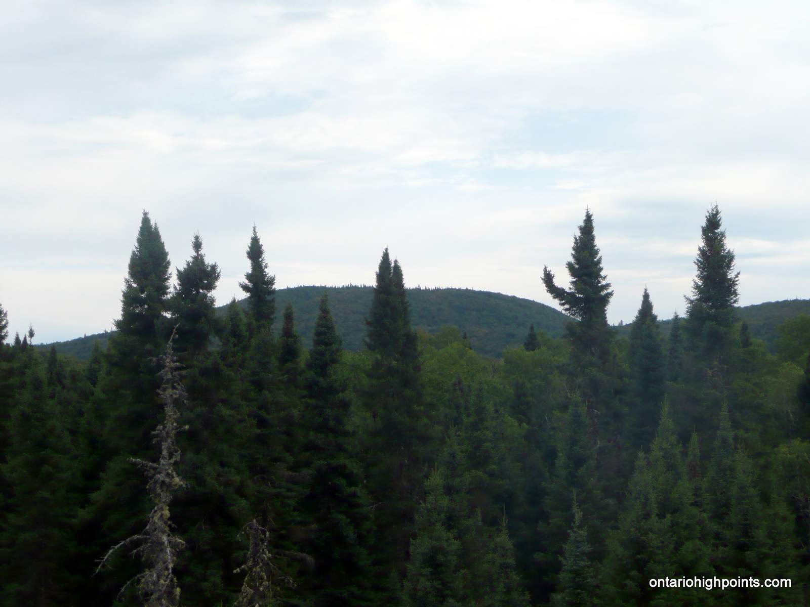
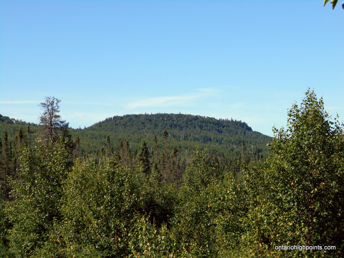
Tip Top Mountain
Posted by Derek on Jul 28, 2023
Ontario 2100 Footer Rank: 20
Height: 2103 feet / 641 meters
Lat/Lon: N48.2734 W86.0037
Clean Prominence: 988 feet / 301 meters
Line Parent: Blackspruce Lake Peak
Key Col: N48 17.390 W83 57.048 (1115ft / 340m)
GPS recorded height: 2113 feet / 644 m
Date Summited: July 23, 2023
Description:
Tip Top Mountain is located in Pukaskwa National Park which is on the northeast shore of Lake Superior between Wawa and Marathon Ontario. Its summit is 641 m (2,103 ft) above sea level and 457 m (1,500 ft) above Lake Superior. It lies north of the Swallow River, about 10 km inland from Pukaskwa’s Coastal Trail and Lake Superior. Before 1966, Tip Top Mountain was considered the highest point in Ontario. Read the rest of this entry »
Ishpatina Ridge (North Peak) – Overland
Posted by Derek on Sep 23, 2019

View to North Ishpatina summit
Height: 2234 feet / 681 meters
Lat/Lon: N47.333 W80.7336
Clean Prominence: 604 feet / 184 meters
Line Parent: Ishpatina Ridge (Tower Summit)
Key Col: N47 19.742 W80 44.593 (1640 ft / 500 m)
GPS recorded height: 2247 feet / 685 m
Date Summited: August 9th, 2019
Overview:
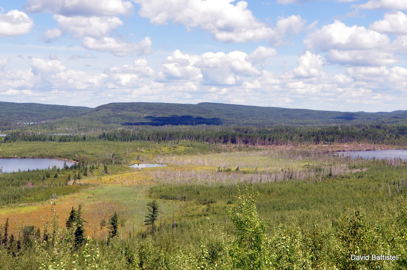
The Ishpatina Ridge traverses several rounded humps and under the Ontario 2100 Footer criteria, 3 of these qualify as being distinct 2100+ foot peaks. The familiar Fire Tower summit of the Ishpatina Ridge is the highest point in Ontario and a popular destination. It is reachable via a trail from Scarecrow Lake. The North Peak as seen from the Fire Tower summit appears to be just as high, but according to Ontario’s Ministry of Natural Resources Ontario Base Maps (OBM) series, it is 43 feet lower. There is no trail to the North Peak of the Ishpatina Ridge and the route from Ishpatina – Tower Peak is hindered by the steep cliffs surrounding the peak.
Parch Creek Peak East
Posted by Derek on Sep 12, 2017
Parch Creek Peak East as seen from a clearing on route
Height: 2123 feet / 647 meters
Lat/Lon: N47.6288 W84.3851
Clean Prominence: 548 feet / 167 meters
Line Parent: Blackspruce Lake Peak
Key Col: N47 37.329 W84 18.058 (1585 ft / 483 m)
GPS recorded height: 2153 feet / 656 meters
Date Summited: September 2nd, 2017
Overview:
Parch Creek East Peak is a remote peak in the Algoma Wilderness, located 24 km north-northeast of the Agawa Canyon and 10 km southeast of Millwood, a stop along the Algoma Central Railway. Parch Creek, the closest significant body of water from which the mountain is named, winds it’s way west into the Agawa River at the Algoma Central Railway.
Little North Lake Peak
Posted by Derek on Feb 24, 2017
Little North Lake Peak as seen from the Border Route Trail, MN
Height: 2100 feet / 640 meters
Lat/Lon: N48.1396 W90.5864
Clean Prominence: 436 feet / 133 meters
Line Parent: Prelate Lake Peak
Key Col: N48 11.169 W90 22.162 (1706ft / 520m)
GPS recorded height: 2119 feet / 646 meters
Date Summited: July 31, 2016
Overview:
Rising 500 feet above the Gunflint-North Lake chain, Little North Lake Peak lies at the southwestern edge of a range of hills west of Thunder Bay. Situated just 2 km north of the (Minnesota-Ontario) border, the peak can be accessed via a rough trail which traces the route of the defunct Port Arthur, Duluth & Western Railway.
Sunbeam South Peak
Posted by Derek on Feb 19, 2017
Sunbeam South Peak ridge
Lat/Lon: N48.1698 W90.4808
Clean Prominence: 384 feet / 117 meters
Line Parent: Little North Lake Peak
Key Col: N48 09.093 W90 32.926 (1739ft / 530m)
GPS recorded height: 2106 feet / 642 meters
Date Summited: July 30, 2016
Overview:
Sunbeam South Peak is a part of a group of hills located on the northwest shore of Lake Superior, not far from the city of Thunder Bay. It is located 3 km west of Addie Lake and 2 km south of Sunbeam Lake.
Head Lake Peak West
Posted by Derek on Jan 31, 2017
Head Lake Peak West
Height: 2133 feet / 650 meters
Lat/Lon: N48.2982 W90.1613
Clean Prominence: 262 feet / 80 meters
Line Parent: Head Lake Peak East
Key Col: N48 17.420 W90 08.780 (1870ft / 570m)
GPS recorded height: 2152 feet / 656 meters
Date Summited: July 29, 2016
Overview:
Head Lake Peak West is the westernmost peak in the Head Lake Peak grouping; 3 peaks 65 km West of Thunder Bay. The Peak is located due north of the lake from which it is named: Head Lake, 3.0 km due west of it’s higher neighbour Head Lake East Peak and 5.1 km west-southwest from Tower Mountain, which is the highest mountain in the area.
Head Lake Peak South
Posted by Derek on Jan 8, 2017
Head Lake South Peak
Height: 2133 feet / 650 meters
Lat/Lon: N48.2928 W90.136
Clean Prominence: 164 feet / 50 meters
Line Parent: Head Lake East Peak
Key Col: N48 17.659 W90 07.802 (1969ft / 600m)
GPS recorded height: 2165 feet / 660 meters
Date Summited: July 28, 2016
Overview:
The Head Lake Peaks are a group of peaks situated north of Head Lake in the hills 65 km West of Thunder Bay. Head Lake South Peak shares a ridge with it’s higher neighbour Head Lake East Peak. There are no trails to it, however an overgrown trail passes within 1 km of the summit. There are only limited views at the summit.
Tower Mountain – Revisited
Posted by Derek on Jan 8, 2017

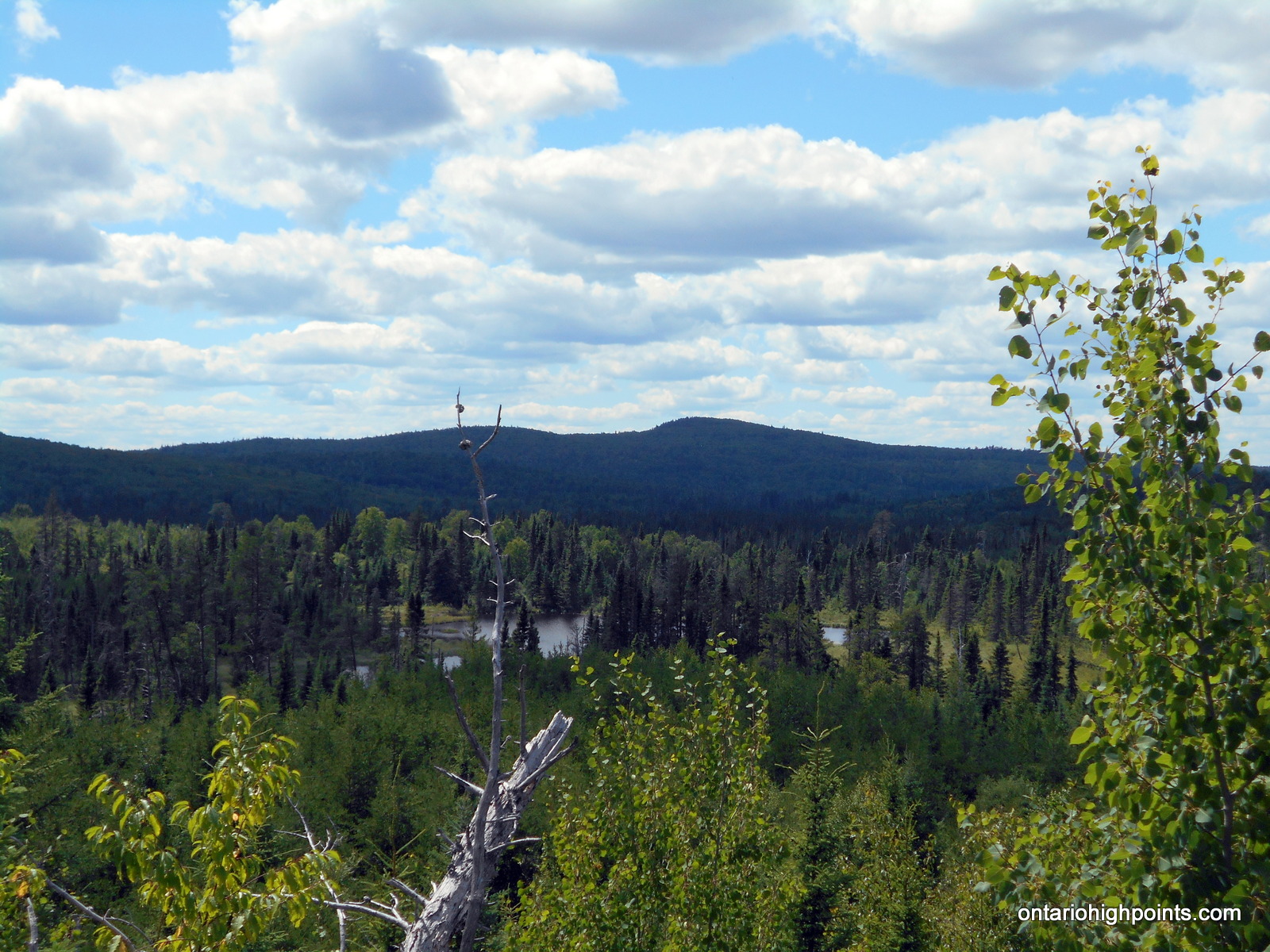
Tower Mt as seen from the road to Head Lake Peak East
Height: 2234 feet / 681 meters
Lat/Lon: N48.3074 W90.0945
Clean Prominence: 659 feet / 201 meters
Line Parent: Ishpatina Ridge (Tower Summit)
Key Col: N49 35.298 W85 41.667 (997ft / 299m)
GPS recorded height: 2260 feet / 689 m
Date Summited: July 28, 2016
Overview:
Tower Mountain is the second highest peak in Ontario. The peak is part of the range of hills on the northwest shore of Lake Superior, 45 kilometers west from Thunder Bay.
The name “Tower Mountain” is relatively new. For many years this summit was just known as a unnamed spot elevation in the “Thunder Bay Hills”. But the recent Ontario Base Map (1:20,000) published by the MNR (Ministry of Natural Resources) clearly labels the summit with its name and elevation. Ironically, the MNR seems to have forgotten that a tower was ever constructed here.
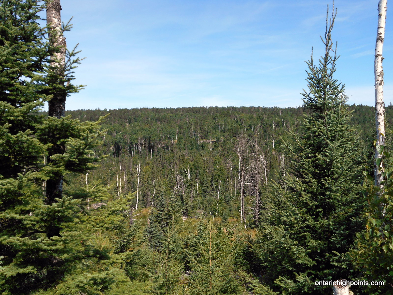
The peak is a flat-topped ridge, with steep slopes and cliffs surrounding the central plateau. The summit is a very broad flat area with lots of clearings and debris from an old tower. You can see the tower footings, the wreckage of the wooden observation box, old cables, and electrical junk lying around. There are no views at the summit, but if you make your way west for 150 meters you will come to the top of the cliffs where you’ll be able to get a nice vista of the surrounding area.
Carson Creek Peak – Revisited
Posted by Derek on Dec 13, 2016

Aldina fire tower atop Carson Creek Peak from the Boreal Road
Height: 2198 feet / 670 meters
Lat/Lon: N48.3547 W90.0132
Clean Prominence: 230 feet / 70 meters
Line Parent: Tower Mountain
Key Col: N48 20.675 W90 01.146 (1969ft / 600m)
GPS recorded height: 2264 feet / 690 m
Date Summited: July 27, 2016
Overview:
Carson Creek Peak is the fourth highest summit in Ontario. The peak is the second highest point along a ridge which runs northeast from Tower Mt. The Aldina fire tower still stands at the summit. Carson Creek Peak is the highest offroad accessed peak in Ontario.
Grey Owl Peak
Posted by Derek on Dec 12, 2014

Grey Owl Peak
Height: 2103 feet / 641 meters
Lat/Lon: N47.2503 W84.2273
Clean Prominence: 489 feet / 149 meters
Line Parent: Alvin Lake Peak
Key Col: N47 15.028 W84 14.486 (1411ft / 430m)
GPS recorded height: 2102 feet / 641 meters
Date Summited: August 15, 2014
Overview:
Grey Owl peak, named after nearby Grey Owl Lake (2 km west) is a remote Algoma Peak which affords outstanding views of the area. From the summit, many of the high Algoma hills are visible, including Alvin Lake Peak, Ogidaki Mt., Griffin Lake Peak and Batchawana Mt. Even though the Peak is less than a 1 km bushwhack from a road*, due to the distance from from a major road (55.8 km away from Hwy 17), it is a difficult mountain to access. As the Ontario Basic Mapping (OBM) series maps show a 640 meter contour at the summit, this peak meets the Ontario 2100 footer list criteria.
* Mile 38 Road becomes a 2-track road north of the Batchawana River